Attractions of Mongolia
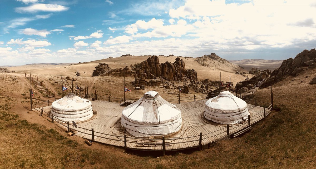
13TH CENTURY COMPLEX
The complex is established to show the 13th century lifestyles and culture of the Great Mongol Empire. Currently, there are 6 different camps and tribes of the empire and it is the only place you can visit the ancient micro kingdom of the 13th century and experience the genuine way of living and working during that time. Horse relay postal system, Urtuu was created under the Chinghis khaan reign. Uguudei Khaan, the son of Chinghis Khaan developed horse relay service as postal man would be able to rest, eat and change the tired riding horses in every 30km between the stations.
Relay station camp: This camp is located at the entrance. When tourists come in, the guardians inspect tourist’s ticket in the relay station and the servants will guide the tourists to the next camp. Tourists are introduced to a Coat of arms (white and black emblem), military armor, helmet, sword, shield soot of Great Mongolian Empire.
Craftsman’s camp: In the craftsmen camp, you will enjoy observing the craftsmen artwork such as horse hold utensils, women’s ornaments, jewelry, arms and tools etc. Throughout the complex, tourists watch details of the interiors and exteriors closely as they are all handmade.
Herder’s camp: The daily life of herders, pastoral culture, the way of breeding the livestock, the methods of producing dairy products, horse training and catching horses with lasso pole, processing leather straps, riding horses, yaks and camels are available with your choice to experience the life of XIII century in Mongolia.
Shaman’s camp: Shamans from different clans all over Mongolia gather around the bon fire under the blue sky to perform shaman ritual and worship the mother nature and Gods, aiming for one common deed.
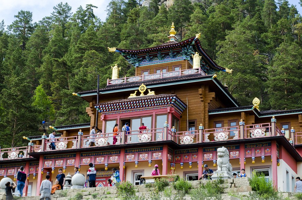
AGLAG BUTEEL - MONASTERY
This monastery is located on the rocky and woody mountainside 100 km away to the northern west of Ulaanbaatar city. When you arrive at the temple, the first thing you see is blue, white, and orange colored stupas which represents Mongolian 3 deities of the Root. A Blue stupa represents the Ochirvaani deity whose role is to protect Mongolian land and people, a white stupa represents the Janraisag deity who protects people from any sufferings and danger, and an orange one represents Manzushir deity who honors the mind. There is paved road until the mountain skirt, then there’s a hiking trial to the temple. There are symbols of temple’s protective deities made by using unique formation of rocks and stones which is created like the animals from Buddhist legends.
There are 2 nature rocks sticking out of the ground inside and outside of the temple, and those was found when people started to build the foundation of the temple. They left those rocks as it was because when they tried to cut and remove them, sudden wildfire was arisen and they thought it was nature’s warning of not to affect those rocks. Fairytale like animals in this temple was made by G.Purevbat, who had the idea building this temple. He used his collections of nature’s unique shaped rocks, tree roots, and other unique things to create these animals that he first saw in his meditation dreams.
On the second floor of the temple, there is a museum called strange things. In the museum, you can see Purevbat’s collection of strange animal’s real exhibits. For example, there is an anaconda’s skin, giant crocodile’s skin, a skull of unicorn, 4 horned ram, 6 horned antelopes, 1 horned mountain goat, 6 horned hog, 5 headed fish with their description of where they found.
After visiting the temple and the museum, travelers can hike by the hiking trails where they are able to see weird shaped different natural rocks and trees.
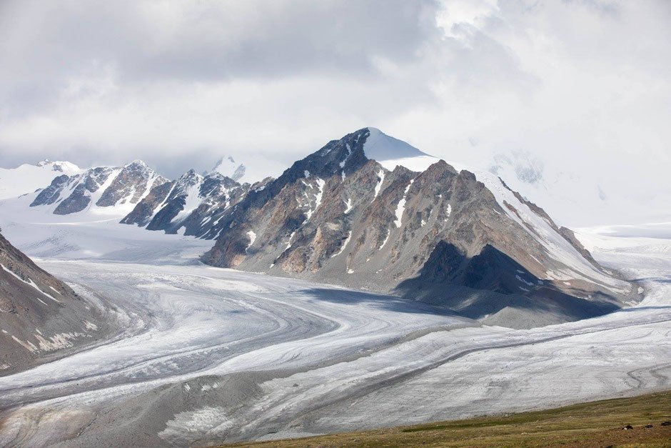
ALTAI TAVAN BOGD (MONGOL ALTAI RANGE)
Mongolian territory stretches 3000 km from east to west. Altai Tavan Bogd Mountain locates in the western borderline of Mongolia. The 5 highest peak of Mongol Altai mountain range called “Tavan bogd”, extends 900 kilometers. Mongolians name “bogd” the high mountains which they respect. Five high peaks are more than 4000 m above sea level and one of them is Mongolian highest point “Khuiten peak”. In 1956, mountaineer have climbed up to “Khuiten peak”, 4374 m high above sea level since then over 1200 foreign and Mongolian mountaineers climbed. The five peaks are covered with eternal snow cap.
20 km long glacier flows in the canyon. There are magnificent river, fast flowing fresh water in the slope of the mountain. In June and July, over 100 kinds of flowers grow, and the snow capped peaks reflects in the beautiful clear lake that is thousands of endangered animals pasture. There are plenty of sites of petro glyphs, carved gravestones, cave paintings, deer shrine graphics, archaeological findings left from the ancient people lived in the 3000 BC.
All these marvelous scenery attracts many tourists. One of the Mongolian ethnic group, Khazakhs live in this mountainous area. They hunt with eagles, perform the Kazakhs khuumii, national throat singing voice. Many tourists like to go for trekking near glacier, see flowers, explore Khazakhs lifestyle and eagle hunting, see the trace of ancient people such as petro glyphs.
Potanin glacier: Is a huge mass of ice caused by the pressure of gravity on high mountain areas. The Potanin ice river was discovered between1876-1899 by Russian scientist G.Potanin while he was doing a research in Mongolia, thus the river was named after him.
Potanin glacier is the largest glacier in Mongolia, 20 km long and 5 km wide. It is considered the glacier was formed 2 million years ago. In 1983, geography scientists studied and defined the total area as being 659km2. In 2005, Scientists researched and found that the ice has melted 378-242 cm. If global warming and climate change continue at their alarming rate, by 2090 the glacier ice will have been completely melted.
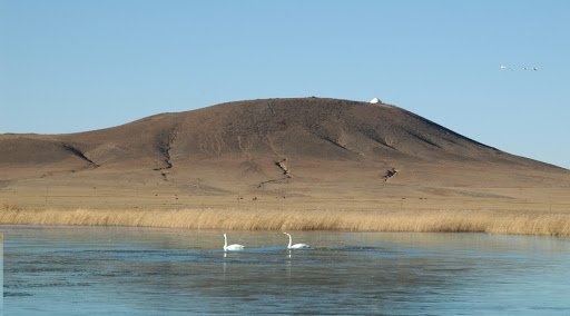
ALTAN OVOO (DARI OVOO)
(Ovoo - cairn - pile of rocks) This place is also known as “Dari Ovoo”. It is one of the volcanoes in Dariganga Soum, Sukhbaatar province, elevated 1354m above sea level. This mountain locates near the center town of Dariganga Soum, also is a main sacred mountain of the locals living in the southern part Sukhbaatar Aimag. It was worshipped by the locals until the early 20th century when Bogd Khaan Jibzundamba, a former theocratic and political leader of Mongolia, had this cairn official worshipped mountain. Worshipping practice was halted during the socialist regime, but revived again in 1990. In 2004, it was declared as a state worshipped mountain and a pinnacle of the cairn was gilded completely.
Golden Cairn is one of the “men only” pilgrimage sites. One who reached the summit is expected to fume juniper and pour a libation to the spirit of the land. Women are strictly prohibited to climb the cairn; instead they climb a small cairn in southern west or walk around the small cairn along particular path. Golden Cairn has a crater flowing northwest. There are Lake Duut in the west and Mount Shiliin Bogd in the east. Main tree on the cairn is known as Sorogshin Tree which is supposed to have been brought from Mount Otgontenger. In order to bring the tree, tea and food samples were offered to calm spirit of the land and water. Sorogshin Tree is ever green fruity tree and Siberian pine refers to this special tree in Mongolia. It is over 300 years since Sorogshin Tree was brought to the cairn without reaching the ground.
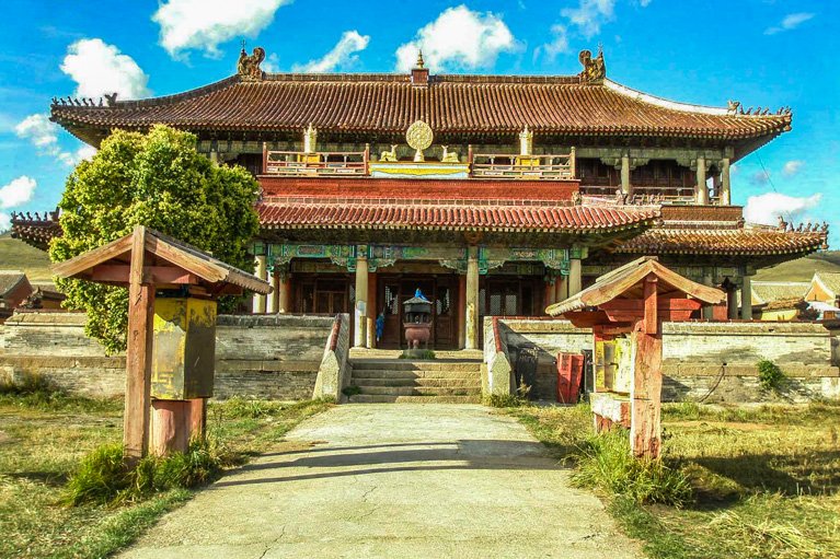
AMARBAYASGALANT MONASTERY
This monastery was built for the memory of Bogd Zanabazar‘s skills, wisdom, intellect, accomplishment, talent, artistic skill and a wisdom, by the order Manchu Emperor, Enkh-Amgalan khaan in 1725. Bogd Zanabazar was a great leader of Mongolians. Amarbayasgalant means “peaceful happiness”. When looking for a site to build the temple, the exploratory group met a boy and a girl named Amar and Bayasgalant, respectively. So these children were playing in a steppe, due to their nature that it was decided that a future monastery at that site would be built and named after those children. When Buddhism was flourishing in Mongolia, the monastery consisted over 50 temples and 6.000 monks. Today, 28 temples of them still stand. During the anti buddhist purges in 1937-1938, hundreds of monks were repressed; their rare deities, artifacts, thangka, statues, and manuscripts were looted without rebuilding or compensation. Later in 1943, The Amarbayasgalant monastery was taken under state protection and reconstructed. The temple has kept the ashes from the burials of III, IV Bogd, leader of Mongolian buddism, they have become religious artifacts.
The monastery keeps many important original scripts of cultural heritage including: the 108 volumes of Ganjuur, and the 226 volumes of Danjuur. The original script of these volumes were written in 1628 and they contain 1260 parts including ancient philosophy, medicine, geography, art, science, music and astronomy.
Next to the Amarbayasgalant monastery, there is a stupa called “Jarun hashor” or “lost the promise”. The legend of this stupa is that, in order to accumulate merit a good hearted old lady wished to build a stupa. To accomplish this she first asked permission from the king. The kings reply stated that she could do what she wished. The old lady started building the stupa with the help of 4 boys and 1 servant. The local ministries refused it and pleaded to the king that a poor lady building a stupa would be harmful to the king’s reputation and the ministries. The king replied that he had already given permission to her so he would not break the promise. That is why the stupa is called “Jarun hashor” or “lost the promise”. Also, it is called the “Eye stupa”, because if the prayers look at the eye on the stupa, all their sin goes away. There is also a 13 m tall Bogd Zonkhoba image with his 2 disciples and 108 stairs.
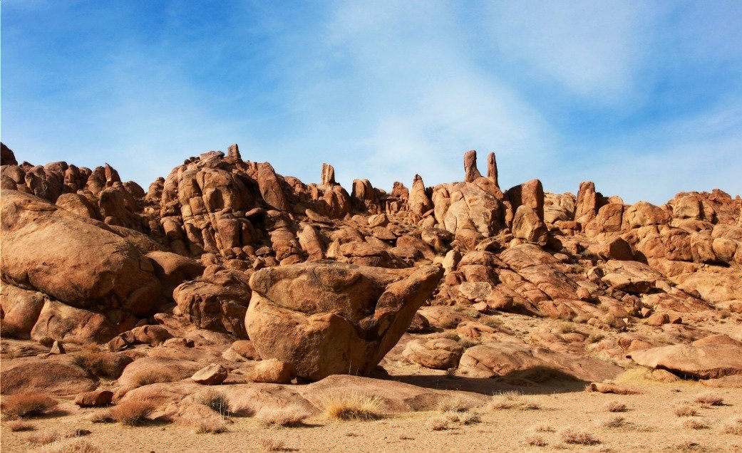
BAGA GAZRYN CHULUU
Baga gazryn chuluu is situated about 37km to northwest from the center of Delgertsogt Soum, Dundgobi province. This area of granite surrounded by flat plains covering 300 square km area elevated 1768m above sea level. In the surrounding mountains and valley, you can see considerable number of ancient graves, khirgisuurs, petroglyphs and monuments besides many gushing springs. There are many sights to see such as a rocky ravine of poplar called Sudutyn am, Jargalant cave, spring of eyesight, Takhilgyn khavtsal, (Takhilga canyon), Ger Chuluu and Hunnu graves.
Ger Chuluu: It contains many cave drawings including a petro glyph depicting a man tying 2 ibex with a rope. This cave painting belongs to the latter period of Bronze Age and attracts greater attention from researchers. On a nearby rock 2 deers were depicted at their real size. One of them is 170cm long and 90cm tall.
Sudutyn Am: This mountain gap was named as Sudutyn Am, because large amount of grass called sud grow in the area. About 300 years ago 2 monks lived as a hermit among poplar groves in this rocky canyon. They erected their home in the area where a brook flows through. So, they could take water inside their home without going out. These monks were entombed here with their creations. Currently, an entrance of the canyon is closed with a fortress. Later in the early 20th century, this canyon was used by Zava Damdin, a well-known representative of Mongolian yellow sect Buddhism, to create his works.
Jargalant Cave: This 18m-long cave is situated 1km far from Sudutyn Am. While going through the cave, one is forced to cover first half of the way on foot but another half by crawling. In ancient time there were crystal-like glittering water drops along the cave wall. Unfortunately, currently there are almost none of them.
Springs of eyesight: Springs of eyesight is 1km far from both Sudutyn Am and Jargalant Cave. The spring comes from a hole which is 50cm deep in rock and its diameter is 7 cm. It is believed that one’s eyesight will be got better if this spring is applied to his or her eyes by using special dipper hung nearby.
Takhilgyn Khavtsal: Takhilgyn Khavtsal is the highest peak of the Baga Gazryn Chuluu elevated 1768 meter above sea level. The mountain has a high rocky ravine making a sight extremely grand. Occasionally, ibex and mountain sheep appear there.
Hunnu Graves: It is possible to see 64 Hunnu graves at once in Dund Shandyn Am of Baga Gazryn Chuluu. In 1989, joint group Mongolian-Hungarian-Russian excavated the area. Distances between the graves vary and a depth of the grave hole is 3.3m. During the excavation many artifacts including a curved ends of a bow, an iron bridle bit and a broken rippled vase were found.
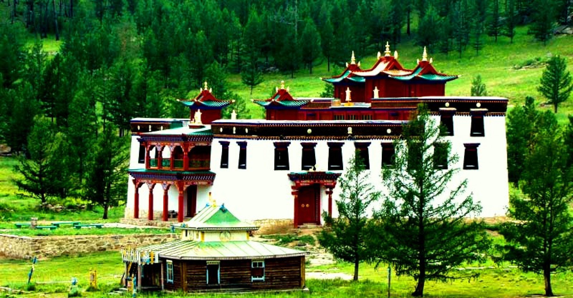
BALDAN BEREEVEN - MONASTERY
(Baldan Bereeven Monastery, “Bereeven” is translated as “rice boiling over”) Baldan Bereeven Monastery – the second largest Buddhist institution in Mongolia -is situated in the front of Mountain Munkh-Ulziit in Umnodelger soum of Khentii province in the eastern part of Mongolia, 300 kilometers far from Ulaanbaatar city. At the end of the 17th century, the Khan of Mongolia invited Lama Tseweendorj to his court and asked him to build the monastery Bereeven somewhere in the east.
While searching for a suitable place for the monastery, Lama Tseweendorj arrived at a pleasant valley in the south of the Delgerkhaan mountain range in which the Khentii Province is now. At the foot of Mountain Munkh-Ulziit, he found a poor family's camp. Lama Tseweendorj met an old couple named Baldan and Zepelmaa, who invited him into their home. As he entered the old couple’s home, he was greeted with the auspicious sign of a pot of rice boiling over on the fire. The Lama took some of the rice. He immediately understood that the rice and the significant names of the old couple were auspicious signs. He therefore selected this area as the place where the monastery would be built. In addition to the rice, they noticed that the mountains surrounding the valley in each of the four cardinal directions resembled important Buddhist protector deities. The construction of Baldan Bereeven began with the erection of a small yellow temple built with local materials. A statue of the god Manzushir, carved from a huge stone by the Lama Tseweendorj himself, was placed at the center of the temple. Construction continued with four storied building of the main temple "Tsogchin Dugan" and named “Bileg –Ulziit” near the first temple. The ground floor alone contained 64 angular pillars and was accessed through three different gates facing east, south, and west. Religious flags were hung at each corner and the roof ridge was richly decorated with gold plated Buddhist symbols such as Soyombo, Mirrors, Dug, Jantsan, Khorol, and the holy antelopes. The next building was constructed the theological department which included sections for astrology, philosophy, and medicine. The monastery soon became one of the most important Buddhist centers in Mongolia, inhabited by 5000-6000 monks. It took nearly 76 years to complete the building construction, was started in 1700s and finished around 1776. For centuries the Baldan Bereeven monastery was famous throughout the "Ar Khalkh" region for its many scholars, lamas, artwork, and cultural treasures. Behind the monastery special formation of rock which is called womb symbolizing rebirth.
Between 1937 and 1939, religious persecution became common and a political opposition began to form. Almost all monasteries, like Baldan Bereeven, have been destroyed during that time. At Baldan Bereeven, "The Yellow Temple," the entire surroundings were destroyed and only the ruins of the buildings remained. For over 60 years it was forbidden to visit the monastery. In 1990s a democracy in Mongolia, a number of monks reestablished some part of the monastery along with the locals. The surrounding rocks of the monastery have been remained with its religious carvings which prove the history of that time.
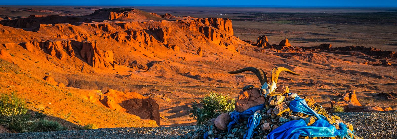
BAYANZAG - FLAMING CLIFF
Gobi desert is rich in native tree saxaul, so it called “Bayanzag” which means a lot of saxaul tree. “Ulaan khavtsal” is a Red shore of clay formations formed because of wind and rain for thousands of years. It has a unique 5km wide texture and is approximately 8km long. American paleontologist first found dinosaur bones and eggs in the area while he was researching a trace of ancient people with his crew in 1922. While they were going from Beijing to Uliastai in Mongolia expediting for 1600 km, they got lost on the way. Therefore they saw randomly fossils in Bayanzag, Roy Chapman and his American friends were surprised and stunned, and screamed with a joy.
Many discoveries were made by an American paleontologist Roy Chapman Andrews and his team. First they excavated in 1922, it is renowned throughout world because of the number of dinosaur bones and eggs found in the area while he was researching trace of the ancient people. That is why; they contributed Bayanzag “Flaming cliff” become famous in the world. The team fell in love with new discoveries and came back to do the excavation in Bayanzag. 3rd time the team discovered dinosaur nests with an egg, also three new kinds of dinosaur eggs by stealing and eating Oviraptor. Americans not only analyzed the eggs, fossils of dinosaur bones also discovered the first trace that dinosaurs called giant squid laid eggs in Mongolian desert that discovered in Bayanzag. This dead trace press is considered extremely rare finds making flaming cliff unique in the world.
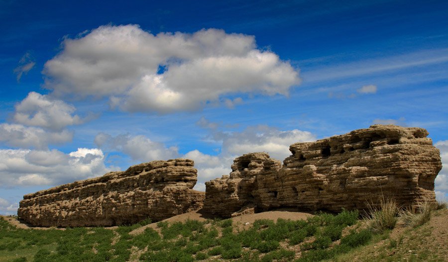
BIIBULAGYN RUIN (BAIBALIK CITY)
Uighar city ruin, Baibalik, is situated 14km to west from the center of Khutag-Undur soum, Bulgan province and locals also call it Biibulag. 44 line of inscription was written on the stele which was built in Saikhan soum, Bulgan province. In the inscription, Uighar king Myunchur says that “I ordered to establish Baibalik city on bank of Selenge River”. Therefore, researchers claim that this city was built by Myunchur, a king of Uighar. Since its construction, the city had always been visited by Sogd (current Tajikistan) and Chinese merchants, Sogd preachers.
They did a missionary work and translated Buddhist writings into Uighar language. Baibalik was a flourishing city and one of cultural centers in central Asia of that period. There were two fortresses built of clay in the city. But most part of them collapsed and only east and north section of the northern fortress remained currently. This remained fortress is 4m high and 2m thick. Many tiny holes on the fortress are supposed to have been used for observing outside. On northern fortress of the city there was a large temple surrounded by lions of male and female. In 840, Baibalik city was destroyed by Kyrgyz nomadic tribes from Yenisei River. All books and sutras were burned during this destruction.
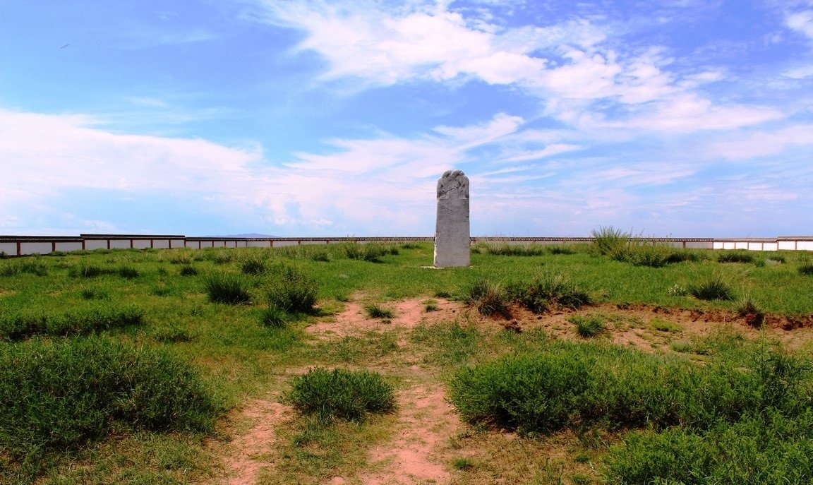
BILGE KHAN AND GENERAL KUL TIGIN COMPLEX (KHUSHUU TSAIDAM MEMORIAL COMPLEX)
Turkic empire was flourished during the 6-8th century in current Mongolian territory and Bilge khan was the last king of the empire. Khushuu Tsaidam memorial complex, dedicated to Bilge khan of Turkic empire and his younger brother general Kul Tigin, is situated 40km to northeast from Karakorum and 20km to east from Ordubalik in Khashaat Soum, Arkhangai province. Kul Tigin’s grandson, Iolug Tegin, had this memorial built. Bilge khan’s stele, known as Orkhon Inscription, is 3,3m high, 1,3m wide and has 68 rows of inscription. Bilge khan ruled the empire for 19 years. During the excavation of the memorial in 31th of July, 2001, over 2000 finds were found and the most important one among them was a gemstone inlaid golden crown of Bilge khan. It was formerly an entire complex, but only this stele has been remained currently. There are over 40 runic stelae in Mongolia and about 10 of them are located only in the Orkhon Valley; that is why it was named Orkhon Inscription. A trace of square burial protected by a parapet wall was in the complex. But this burial is considered to be an artificial one without a real human corpse which had a symbolic meaning. Fragment of tiled roof with an image of nomads shooting each other while galloping was found from the site. These 2 stele of Bilge khan and Kul Tigin are 1km apart from each other. These memorials were recognized as a “cultural landscape” of the UNESCO World Heritage in 1996, although they had been destroyed much throughout its history of thousand years. Mongolia announced 20.8 square km area around the complex as a zone under state protection in 1961. Ulaanbaatar, a capital of Mongolia, was once located in the area when its name was Shar Bust Urguu and it had settled in this area for about 14 years since moved from Lake Shireet Tsagaan.
This monument of Kul Tigin, a famous general of Turkic empire, is situated on right bank of Orkhon River in a valley of Lake Tsaidam 60km north from Karakorum in Khashaat Soum, Arkhangai province. The steles in the complex have been explored for over hundred years. In 1958 Mongolian-Czechoslovakian joint research group excavated the complex completely. Kul Tigin, the general of Turkic empire (A.D. 552-745), was born in 684. The intelligent, skillful general, Kul Tigin, had devoted himself to state affairs since he was only 16. In 732, after his death in 731 at the age of 46, Bilge khan had this sacrifice complex and a temple of worship established. The sacred complex was protected by a 1m-thick brick fortress surrounded by a moat enclosing 67m long, 29m wide area. Empty space inside the fortress was filled with bricks of 32x32x6cm size. Many findings including mud vase, adornments of iron, a roof fragment, a dustpan and a vase were found from the complex. The monuments realistically represent appearance, clothing, utensils and adornments of people of that period.
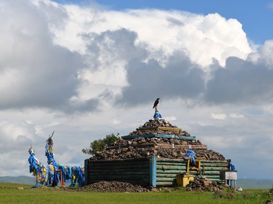
BINDER OVOO (BINDER CAIRN)
This cairn of rock located on a special establishment built by shurgaag tree is situated in Batshireet Soum, Khentii province. To the southeast about 1 km far from the cairn, there is Rashaan Khad covered with various kind of stamp marks and ancient petroglyphs. These distinctive stamp marks and cave drawings belong to a different period of history. Drawings on the rock include ancient animals like a first mammal rhino, a lion, the most long lived huge mammal and an elephant. These drawings proved that ancient people living around the Khentii range 40000-14000 years ago had been living by hunting these animals.
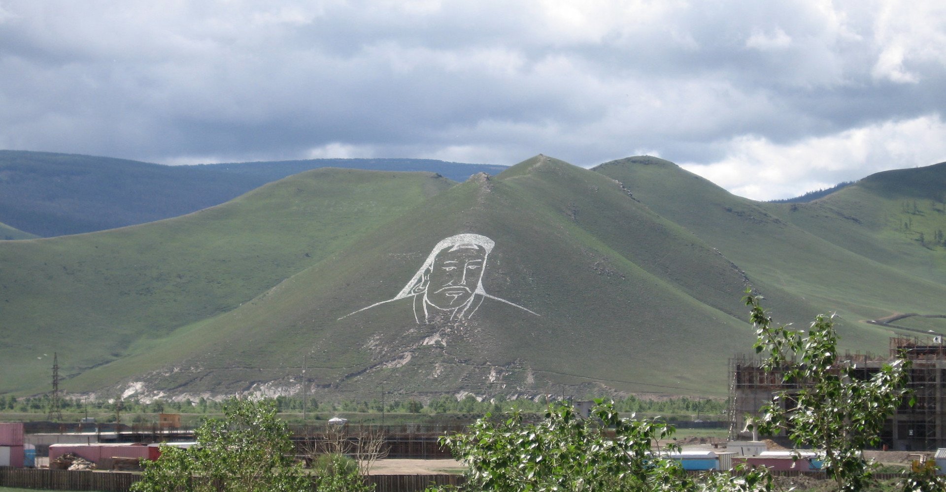
BOGD KHAN MOUNTAIN
The Bogd Khan Mountain in the south of the Khentii mountain range lies on the border between the woodland and the steppes. The southern side of the mountain is composed of larch forest. It and its foot hills span from the east to the west. The highest peak of the mountain is Tsetsee Gun, which is 2268 m above sea level, and the second highest peak is Tushee Gun, which is 2256 m above sea level.
The Bogd Khan Mountain was one of the world’s first mountains protected by the government for conservation purpose. There’s a legend about how Van khan Tooril protected and worshipped the mountain and he named the mountain Khan Mountain between the 12th and 13th centuries. In 1778, according to the decree of Khuree minister Yunderdorj, Bogd Khan Mountain was determined as a conservation area protected by the government. This decree was restated again in 1957, 1974, and 1995. Bogd Khan Mountain plays an important role in generating Ulaanbaatar city’s pleasant weather. Small rivers start from the 20 gaps of Bogd Khan Mountain, and some of them flow into the Tuul river, one of the Mongolian longest river and other small rivers reach the mountain’s skirt and sink in the soil. Bogd Khan Mountain contains several medical hot springs, 54 species of mammal, 1660 species of insect, and 194 species of bird.
The Bogd Khan Mountain botany is composed of cedar forest, pine forest, larch forest, and a spruce forest which dominates the upland area of the Khentii mountain range. In total, 588 species of plant grow in the mountain. Around the Bogd Khan Mountain’s valleys, there are many historical sites to encounter. These include traditional rock art, ancient burial mounds and tombs.
The ancient legend of Bogd Khan Mountain describes an ancient battle between: Bogd, the archery hero and wrestler Chingeltei that ultimately led to the geographic features formation. One day, Bogd the archery hero decided to take Tuul, the beautiful mermaid, as his wife. But Chingeltei the wrestler loved her as well. The two warriors agreed to a fight, the winner of the battle would take the beautiful mermaid girl as a prize. After a fierce battle, Bogd the archery hero was pronounced as a victor. Upon his defeat, Chingeltei wrestler said: “By the rule of our agreement, you have won the right to take Tuul. However I have a request for you, because I will always love Tuul, please take my head and place it in front of you. For even when I’m dead I wish to be look at her” he said/. According to Chingeltei’s request, the hero Bogd cut Chingeltei’s head off his body and placed it in front of him. Today, this scene is represented by Zaisan hill, Chingeltei, the wrestler, is the north mountain of Ulaanbaatar city.
BUGIIN TSAV
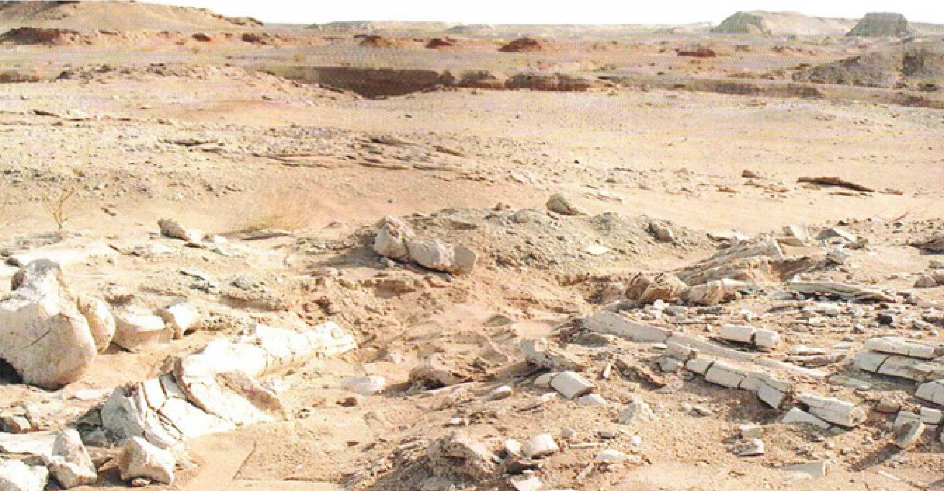
Bugiin Tsav is situated 50km to north from Khermen Tsav in Bulgan Soum, Umnugobi province. The area is rich in fossilized dinosaur finds. Fossils of many different species like dinosaurs, a turtle, a fish and a mollusk along with interesting traces showing their lifestyle lie on the ground everywhere and it really pique researcher’s interest as well as people’s interest. Skeleton of carnivorous Tarbosaurus found in the area is now being kept as a show in the Museum of Mongolian Natural History. Bugiin Tsav is a special protected area in the national park, Gobi Gurvan Saikhan.
CHIN TOLGOIN BALGAS
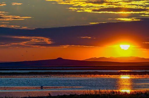
This ancient city ruin is situated in a sunny side of a small hill, Chin Khairkhan, which is 16km far from Dashinchilen Soum in Bulgan province to east. The ruin consists of a watchtower on hilltop, a fortress ruin and abandoned sites of a yurt outside the fortress. There is a currently 10m-high watchtower on northwest of the fortress and it was made of granite and dark grey siliceous rock. From the watchtower 20-30km area can be seen. There are also ancient stele’s base and 2 large stone turtles. Several roof-tiles inscribed in Khitan state, one of Mongolian empire, and furnace remains of approximately 1000 households were found around the fortress. As a result of the research, it became clear that this is a ruin of Chjen Chjou, a city of Khitan state.
A Chinese monk Chani Chun Bumba who traveled through the site in the 13th century on the way to Genghis khan recorded that it was a ruin of Chjen Chjou city of Khitan state and also he said there were three other Khitan city ruins west from Tuul River. Khadaasangyn or Khar Bukhyn Balgas is on the west and Talyn Ulaan Balgas is on the right side of Chin Tolgoin Balgas. All of them date back to the same period. According to the sutra, this city was being inhabited by about 20,000 soldiers of northwest tribe of Khitan state and over 700 Chinese and Zurchid families who had been exiled to the city. Researchers regard that establishment of the city started during the Uighar period and expanded during the Khitan period. Later, during the period of Prince Tsogt, it had been used as a military camp and a watchtower. This is a unique architectural example because the fortress was built by conglomerate. The watchtower is supposed to have been 30m high with a base of 40m in diameter. It was built of rocks and stones carried from a mountain. Chin Tolgoin Balgas was taken under state protection in 1998.
CHINGGIS KHAAN STATUE - DADAL SOUM
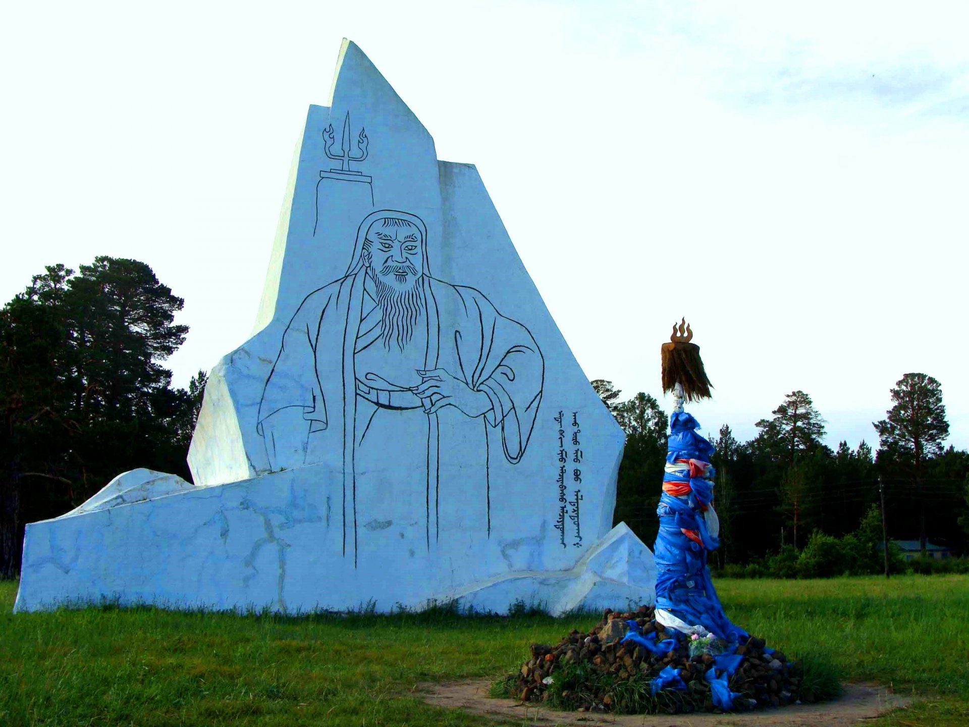
Dadal - legendary birthplace of Chinghis Khaan: Dadal Soum in the Khentii province is the legendary birthplace of Chinghis Khaan. As it is written in “The Secret History of the Mongols”, Great Chinghis Khaan was born at the tributary of the Onon and Balj rivers in the current region of Dadal Soum. In 2000, Onon-Balj is a National Park which covers 400,000 hectare of land in this region. The Dadal region is a gorgeous area with lakes, rivers and forest.
The Monument of the great Chinghis khaan in Dadal Soum is located next to the Gurvan Nuur spring, which means “Three Lakes” and it is naturally beautiful area. The historical stone monument built in 1962 was constructed to commemorate the 800th anniversary of Chinghis Khaan’s birth. This 12m high, 4m thick and 10m based monument was designed by sculptor, L.Makhbal. There is an inscription of Mongolian traditional script on the monument saying “Chinghis Khaan myself don’t matter if only my state is in peace and in order”. On the back of the monument is written another inscription saying - “Dedicated to the 800 years birth anniversary of Chinghis Khaan, a founder of the Mongol Empire”.
CHINGGIS KHAAN STATUE COMPLEX
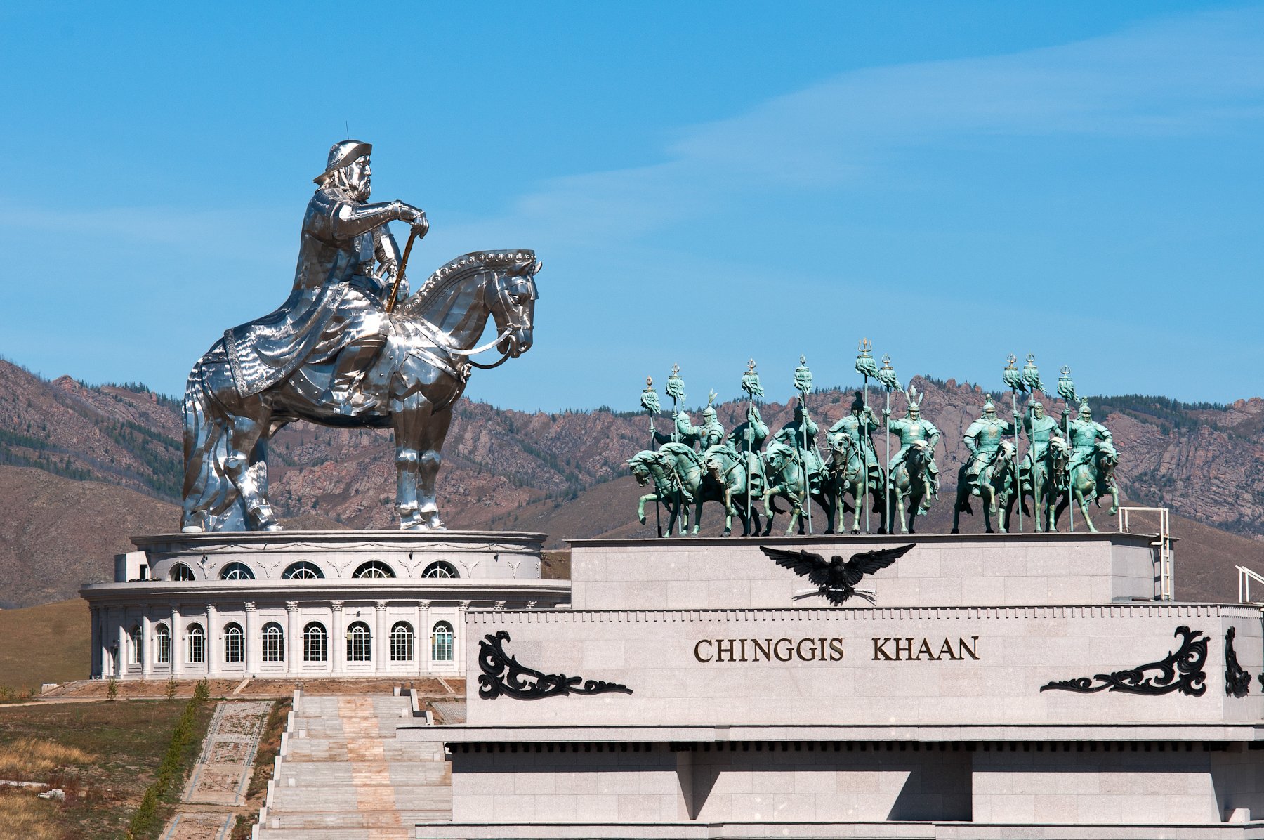
The equestrian statue of Chinghis Khaan was built for occasion of the eight-hundredth anniversary of the foundation of the Mongolian Empire, in honor of its founder, Chinghis Khaan. This huge stainless steel statue is 250 tons and 40 meter high. It is the highest statue representing a man on a horseback. It is located in the place called Tsonjinboldog on the banks of the Tuul River 54 km from Ulaanbaatar city.
According to history, Chinghis Khaan found a horsewhip on the way back from Tooril khan of Khereid tribe. The reason why he went to the Khereid tribe was to ask for help because Mergid had captured his wife. It is perceived that finding a horsewhip brings you luck in Mongolia. The statue is turned towards East, the conqueror's birth place. It stands on a 10-m high base that is surrounded by 36 columns representing the 36 kings of Mongolia who are direct lineage of Chinghis Khaan.
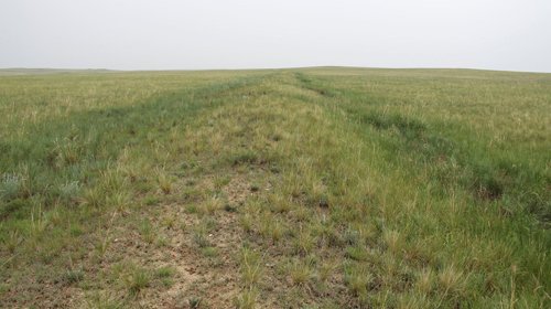
CHINGGISYN DALAN
This 500-600km long earth fortress stretches from west of old center of Baruun-Adarga Soum of Khentii province passing north of Lake Sain Tsagaan through Norovlin Soum, Bayandun Soum, Dornod province and Khermyn Khudag in a terrain of 3 Soums, Tsagaan-Ovoo, Sergelen, Gurvanzagal. It discontinues at several parts and only some parts or 300km of the fortress is in a Mongolian territory. There are some small earth fortresses measuring 40m x 50m where guards sat in.
For instance, Durvuljin Buudal, Ulzyn Undur, Dovyn Kherem, Mogoin Adagiin Kherem, Uguumuryn Kherem, Delgerekhyn Tal and Bayanbulagyn Kherem. It is said that it takes midday or a whole day to travel between each fortress. Some of them are 8-12km apart from each other. There were no traces that someone lived in the fortress, but vase and bowl remains were found. Fortresses like them are said to have found in large numbers along Chinghisyn Dalan. It is also said that fortresses of midday are shape triangular and fortresses of whole day are shaped square. In southern Mongolia there are also places like it. For example, in Nomgon Soum, Khurmen Soum, Bayandalay Soum and Noyon Soum of Umnugobi province, there is a long earth fortress also called Chinghisyn Dalan. Researchers suppose that these fortresses once were a border of any foreign country. But it hasn’t been researched completely until today.
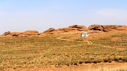
CHOIR MONASTERY
Large number of Buddhist monasteries and temples were built throughout Mongolian territory between 1600 and 1800s. In the eastern Mongolia, in 1779 there was an establishment of one important and powerful monastery. At the beginning, the monastery’s name was “Baldandashgomlin” as Tibetan. During the prosperity of Buddhism in Mongolia, this monastery played the main role to prepare religious staff, especially high educated lamas knowing Tibetan, Indian and Sanskrit and science of astrology. Philosophical creatures of Buddhism, poetries were translated from mentioned languages into Mongolian.
It marked out for monastery’s capacity and how big it was, nearly 1500 inhabitation of Buddhist lamas and 5-7 religious schools and faculties like “Choir”, “Djud”, “Mamba”, “Duinkhor” and etc. Noted handicraftsmen and merchants lived there, except only lamas. Additionally, more than 500 monasteries of the 700 Mongolian monasteries had their own local variations of the ceremony. “Zahra” and “Duinkhor” tsam dance - the most popular religious mask dance were played and the biggest celebration of Buddhism “Maidar ergekh” was held in the Choir monastery as well.
The monastery’s leaders were high mental potential Lamas. The 5th leader was Lama Gonchigdambil, once his camp was on a fire and burnt to the ground but amazingly only single thing was found from camp ashes without any damage. That was the fifth leader’s portrait drawn by him. The portrait is being kept in the Gandan Monastery, present Mongolian biggest Buddhist center. Between 1937 and 1939, religious persecution became common and a political opposition began to form. Almost all monasteries and temples were destroyed. In 1938, this black wind knocked down and set the monastery on fire. Now only the ruin of monastery exists. The Ruin of Choir Monastery was taken into Mongolian State protection in 1993.
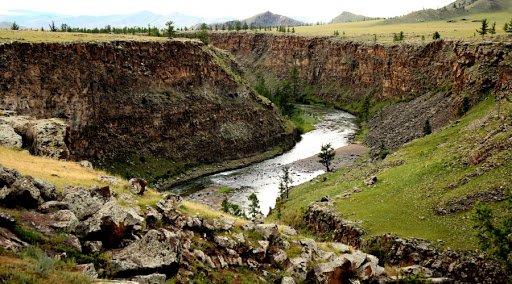
CHULUUT RIVER
Chuluut River in Undur-Ulaan Soum in Arkhangai province comes from mountain Eg of the Khangai mountain range and flows about 415km, forming river Selenge, the biggest river of Mongolia, by joining Delger River and Ider River. Chuluut River flows through 20m-deep steep canyon of basaltic rock for about 100km from the river-mouth of Teel River till Atsat River. A basaltic rock is magma flew from the volcano Khorgo and other volcanoes near it. There is a small waterfall flowing down from a steep rock near a confluence of Suman and Chuluut rivers. This waterfall is known as Choidogyn Borgio and it is interesting to see fish gathered from Chuluut and Selenge rivers flashing the surface upwards waterfall. Chuluut River canyon is rich with springs of hydro carbonate, sulfate and sodium, and contains many petro glyphs date back to Neolithic and Bronze Age. These cave paintings include unique depictions such as images of 6 women giving a birth, a man shooting with a bow and an arrow, herds of ibex and deer, a man standing with raised hands, oxen, mountain sheep, profiled paintings of men and a masked man. These paintings were taken under state protection in 1998.
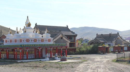
DAMBADARJAILIN MONASTERY
(“Dambadarjailin” means “developing religion”). According to the religious rulers, first and second leaders of Buddhism in Mongolia were chosen from Mongolia. They both were descendants of Chinghis Khaan and were proclaimed as a Bogd Khan or Javzandamba Khutagt. The first leader was named G. Zanabazar (1635-1723) and the second was Luvsandambiidonme (1724 -1758). In Mongolia, Manchu Emperor did a big ritual to saint Second Bogd Khaan at his age of 5 and declared leaving First Bogd Khaan’s all power and privileged Second Bogd Khaan for continuing and developing the religion throughout the country. A monastery was built for the commemoration of the Second Javzandamba Khutagt. By the order of the Manchu Emperor, in 1759 after the second Bogd khaan death, the monastery was named “Dambadarjailin Monastery”.
Construction of the monastery was built in 1761 at the confluence of the River Selbe in the northern part of the city and was completed in 1765. In 1937-1938, political repression covered the monastery and a number of monks were executed. Moreover, the temples were closed, and valuable relics, sutras were burnt. The buildings of the monastery were used as resort and hospitals during the socialist Mongolia. After Democratic Revolution in Mongolia, Dambadarjailin Monastery was started to restore by some monks. The government celebrated the 240th anniversary of the establishment of the monastery in 2005. Today, over 50 monks are running the everyday religion activities.
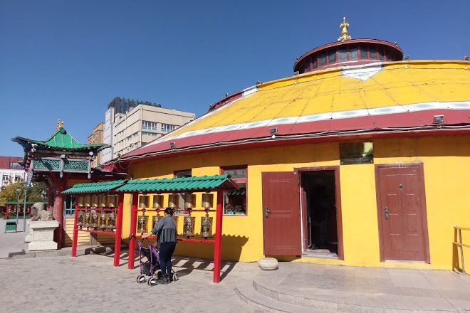
DASCHOILIN MONASTERY
It was one of the most important parts of current Ulaanbaatar city. In the past, Dashchoilin Monastery hosted numerous scientists and monks from all over Mongolia. In 1990 the Zuun Khuree Dashchoilin Monastery was restored. It now has more than 100 monks, three temples-Tsogchen, Sakhius and Gandanchoinkhorlin-and many rare statues. Dashchoilin Monastery in Ulaanbaatar is known by conducting ceremonies such as Maitreya and Tsam religion mask dance every year. In 1998, the Zuun Khuree College was created to provide general education for the community; including basic Buddhist teachings, Buddhist Philosophy and training in Indian, Tibetan and Mongolian languages.
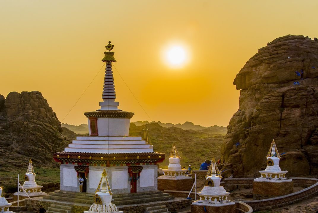
DEMCHOG MONASTERY
(“Demchog” is translated as “supreme tranquility”) There are 33 kinds of different sizes of Gobi desert in Mongolia. One of the biggest and famous is Galba Gobi desert where three monasteries standing 5 - 6 km far from each other and surrounded by the Galba Mountain Range were built between 1830 and 1836. Those three monasteries are known as Galbyn Three Monasteries - Ereet Monastery, Tsagaantolgoit Monastery and Demchog Monastery. Demchog Monastery is located in the southern part of Mongolia, Khanbogd Soum in Umnogobi province, over 600 km from Ulaanbaatar city. The builder was a famous one for his name as the Saint Lord of Gobi. His name was D.Danzanravjaa.
D.Danzanravjaa (1803 – 1856) was born in a poor family in 1803 in the East Gobi, present Khuvsgul Soum in Dorno-Gobi province. Soon he was recognized as a prodigy, writing and performing his own music at age four. In 1808 local Red Hat Buddhists proclaimed him as the reincarnated Fifth Ferocious Saint Lord of Gobi, their spiritual leader when he was 5-year-old. After completing his basic training in Buddhist literature, art, religion and philosophy by the early 1820s, he founded the Khamar Monastery in the East Gobi that would be his headquarters for the rest of his life. Danzanravjaa gave considerable importance to the development of Khamar Monastery in particular, where he established a professional theatre and touring company, public library, museum, and primary school-all of which reflected his serious commitment to the cause of public education. Danzanravjaa's known literary output included more than 300 poetic works, over 100 songs, a philosophical treatise, the ten-volume Saran Khukhuu operetta, and numerous religious tracts written in both Mongolian and Tibetan. Several of Danzanravjaa's songs and poems remain popular until this day such as “Ulemjiin Chanar” commonly sung at holidays and celebrations. In addition Danzanravjaa created several dozen paintings on religious themes. Danzanravjaa's poems, songs and teachings are remarkable for their outspoken criticism of 18th century Mongolian society.
Demchog Monastery was destroyed during the Stalinist purges in 1930. Mongolian people worship the area and the monastery is currently undergoing renovations.
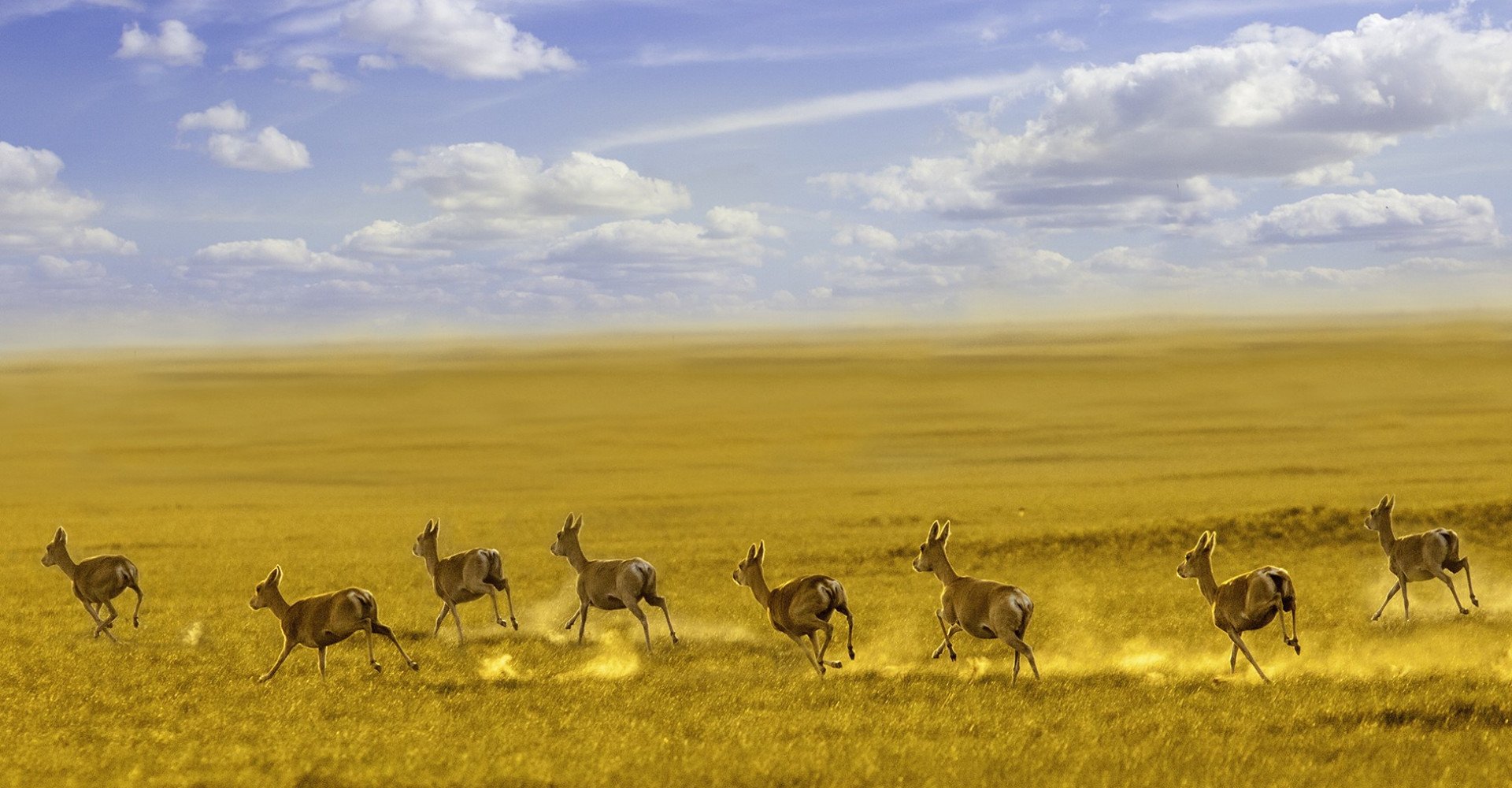
DORNOD MONGOL STEPPE
Mongolia's most vast steppe is called the Menen steppe, located in the Dornod province, 60 km to the west of Lake Buir and elevated 600m above sea level. This is one of the biggest steppes in the world also it is unique because it has largely remained undeveloped. This vast steppe continues all the way till the east side of Mongolia, to Dariganga volcano. The Steppe zone stretches to River Khalkh in the north and lies east of the Khyangan mountain range.
The steppe is divided into 2 main parts: the north side of Kherlen, the south side of Tamsag. The lowest point of this steppe in Mongolia lies in the northern area of the Kherlen. Mongolian famous poet B.Yavuukhulan described the steppe as: “Seeing the sunrise from closer distance than lassoing the horse is amazing” (it means Mongolians lasso the horse from very close, looking the sunrise from very close is more amazing).
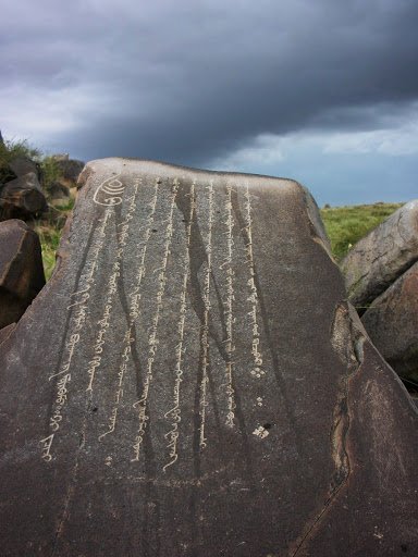
DUUTYN KHAD (DUUT ROCK)
Duutyn Khad is situated near the Mountain Tuvkhun, 20km far from the center of Delgerkhaan Soum in Tuv province. A poem written by Tsogt Taij was carved on this rock so it is known as “Tsogtyn Khadnii Bichig” (Rock Inscription of Tsogt Prince) in 1624. The rock has a deep root under the surface of the ground and it produces a sound when it was bitten, that is why this rock is called Duutyn Khad, meaning singing rock. The inscription dated back to time of 380 years ago was perfectly preserved until today. The meaning of the 30-row poem is that “although their appearances are different, both thief and wolf has a common desire of greediness”. At the end of the inscription, it was said this poem was written on the rock by Daichin Khia and Guyin Baatar in 18th of January, 1624. Many petro glyphs can be found around this rock. In 1971 this important memorial was announced as a zone under State Protection.
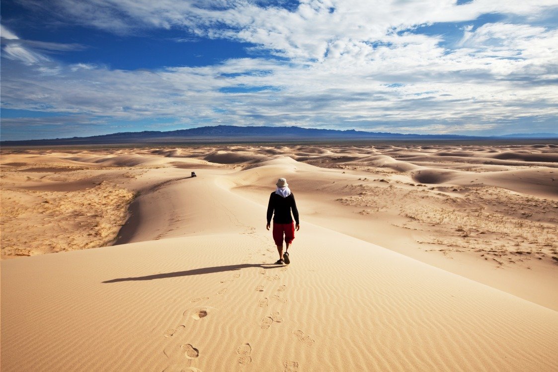
ELSEN TASARKHAI - SAND DUNES
Elsen tasarkhai is a part of the Mongol Els sand dunes, which stretchs along the Tuv, Uvurkhangai and Bulgan provinces. The sand dunes are totally 80 km long. Dividing the southern part of the sand dunes with the so-called northern Mongolian sand, Khugnu Tarna is a main road. River Tarna flows in the western part of the sand dunes and it is sodden under its surfaces, so shrubberies such as willow, elm, dogwood, shrubbery grow there. In the north, there is the rocky and woody mountain “Khugnu khan”. Ikh Mongol which defines the central point of Mongolia lies in the south of the sand dunes. The widest section of the sand dune is located in the Ikh Mongol mountain area and covers an area of 9-10 km2. It is not loose sand so that half of the Ikh Mongol sand is covered with plants.
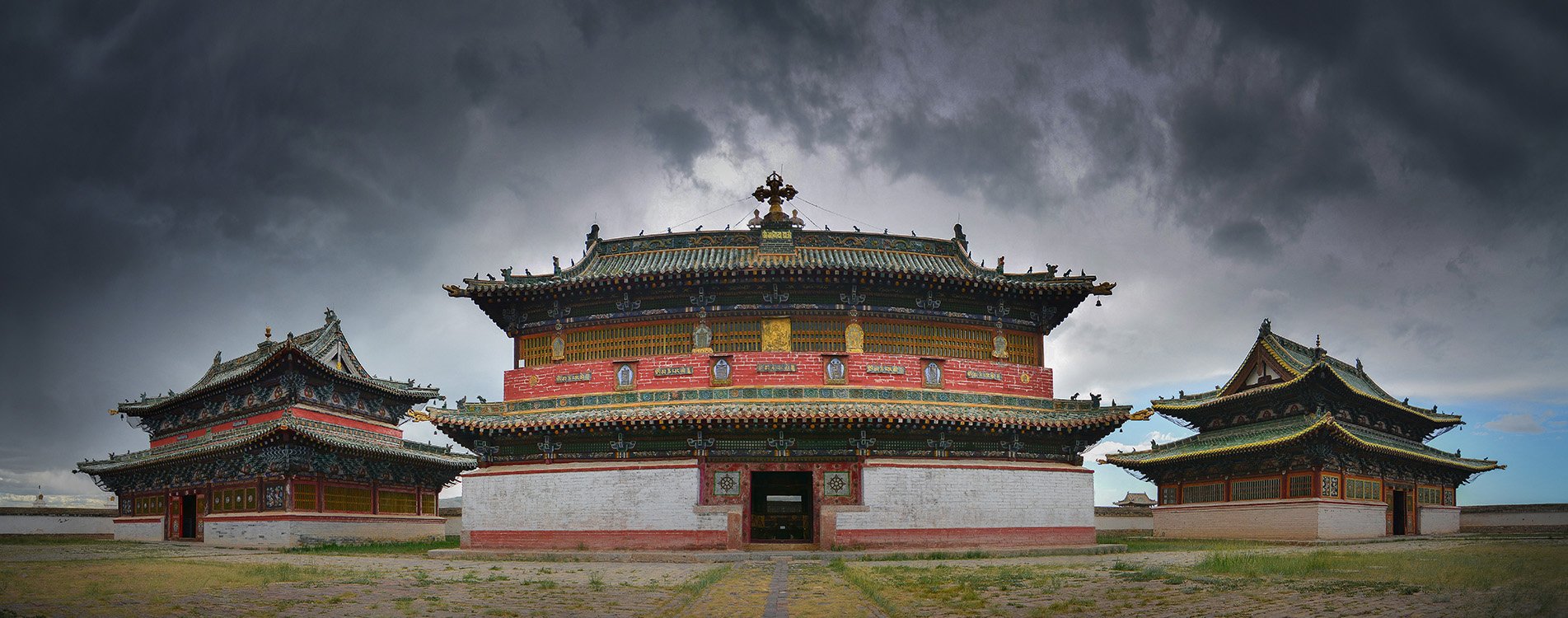
ERDENEZUU MONASTERY
In 1580s, by the order of Dalai Lama first temple of Erdenezuu monastery was built on the ruin of Mongolian ancient capital Karakorum. By 1792s, there were 62 temples, over 500 buildings nearby. The monastery was registered in “Heritage of Mongolia” by UNESCO. Today:
Dalai Lama temple exposes 13 “nagtan” images of Mahakala, six images of 12 Dalai Lama's emanations and copper image of Under Gegeen Zanabazar, first leader of Mongolian Buddhism.
Shorgoogon Fence made by larch without using an iron nail symbolizes to protect the monastery from outer and inner enemies. Also it did not let many people and livestock come in the temple during major religious festivals such as Tsam dance and Maitreya's procession.
Tsamba temple devoted to deity Tsamba, has three rooms. Four Lamas used to occupy each room to recite certain sutras.
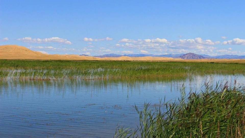
EREEN LAKE
This lake is located in the Govi-Altai province and it is surrounded by sand dunes. River Zavkhan flow into the lake. The lake covers an area of 4km2. The flowers growing on its shore and many flying birds over the lake make this lake incredibly beautiful. Locals call this the “Switzerland” of the Gobi. The lake Ereen has a special structure that does not allow it to be filled up with sand, even though it is located in the middle of the desert. On windy days however it looks like the sands are moving, the lake is still fresh and clear. When the people are thirsty, they assume the lake is a mirage because of the how this looks like. On very hot and dry summer days, it is amazing to see this deep blue fresh lake.
According to legend, 2 host children live in the lake. Early in the morning, at sunrise they play on top of the dunes. They immediately flee into the lake water when they see strangers. According to legend if you see those kids, it symbolizes that you will have good fortune in the future.
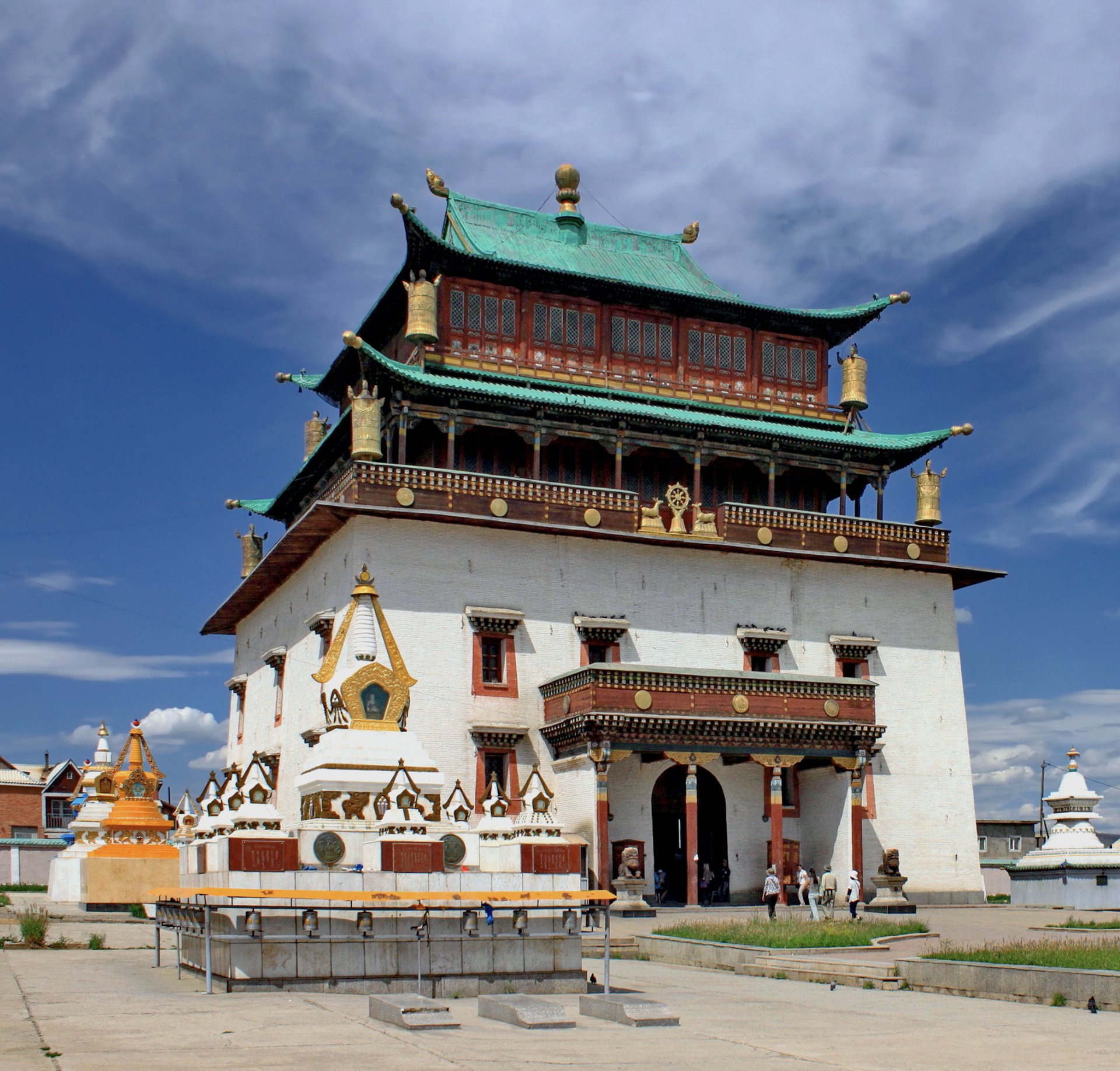
GANDAN MONASTERY
It is the largest and most significant monastery in Mongolia. The first temple of the monastery was built in 1809 and moved to the present location in 1838. Over the next century the monastery included nine institutes, a library and housed around 5000 monks. The Gandan monastery became an important center for learning and practicing Buddha’s teachings in Mongolia.
In 1938, communism spread out in Mongolia, around 900 monasteries were destroyed and turned into museums. The monks were killed, jailed or forced to join the army. In 1944, after a petition from several monks, Gandan Monastery was reopened but its functions were carried out under the strict supervision of the socialist government. In 1990, after Democracy and with Buddhism flourishing once more, Gandan Monastery embarked on an ambitious restoration program around the country. There are currently 10 temples operating at Gandan monastery and there are 900 monks working in the monastery.
KHAMAR MONASTERY
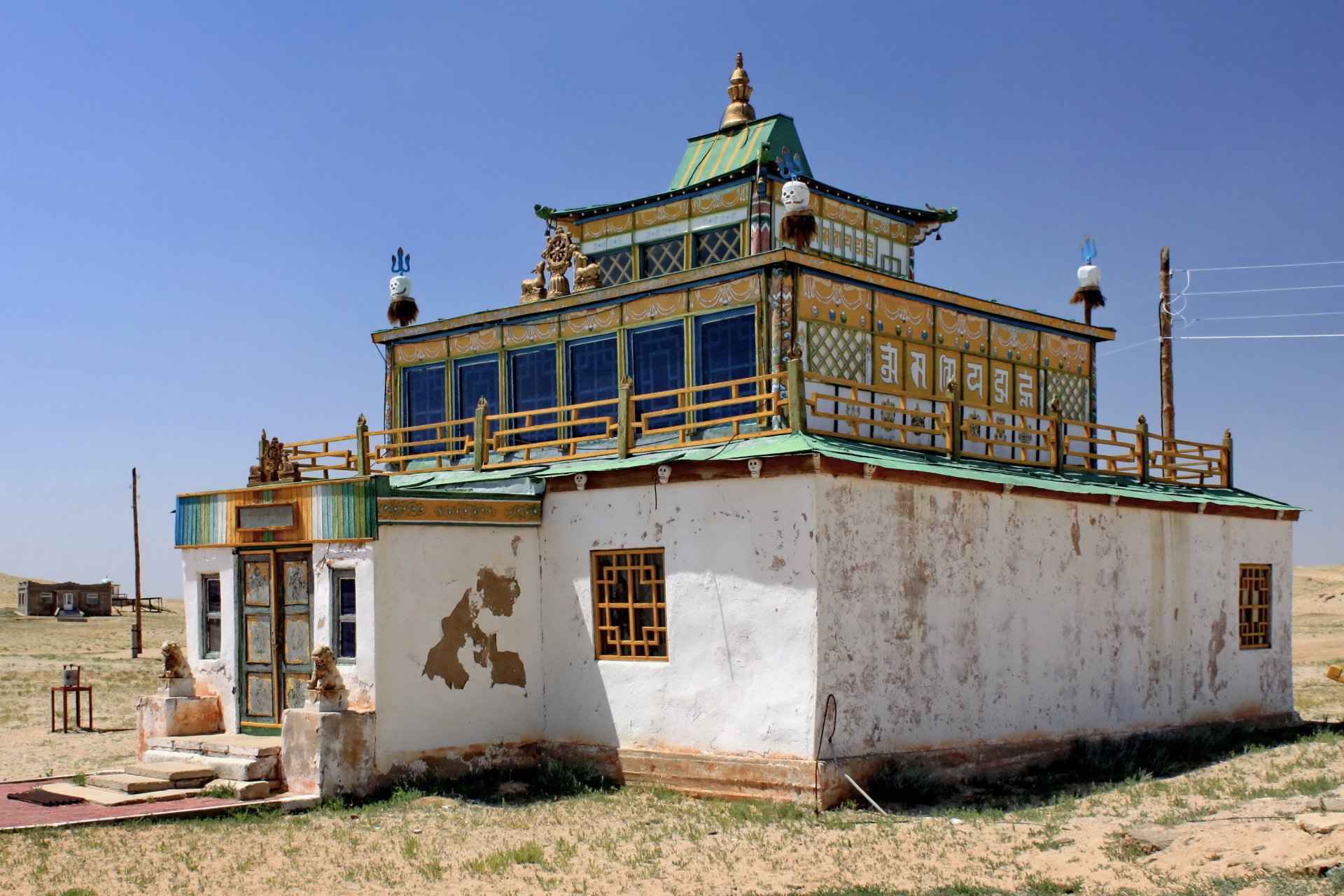
The monastery located in the center of the Gobi, when Buddhism spread in Mongolia in XIX century, yellow and red sect had a war and it is special that red sect developed during that period. Monastery was established in the 1820's by famous 19th century Mongolian educator and poet Danzanravjaa when he was 17 years old. According to a legend of the monastery, upland good man was helping to a poor people in that low land area where the monastery located. There are 3 three pieces’ tree mascot around the temple, where it protects three directions from the various attacks. Besides the religion, he devoted great efforts to the public education, established non religious public school to literate women and children, theatre, museum, and a library. Also he composed to perform a drama called “Saran khukhuu” for one month. None of the 700 temples were in Mongolia operating above mentioned activities.
Next to the monastery, there is a stupa called “Old man” built by copper from the Erdenet mining which was the, main leverage of Mongolian economy. Inside of the stupa, tons of tea plants, 7 tons of juniper, and deity statues, red sect lama’s sculpture, 5 wall Mongolian furnished ger and silk were blessed mantra absorbed special power and put. In the north of the hilltop, there were an interesting rock called breast rock. Also, there were some special places with red small rocks where you sit or lay around to get energy from the world energy center or they call it “Shambala heaven”. Shambala mean intellectual enlightenment mental break selfishness basis. 108 stupas built around the area, if you come there before sunrise you will receive a good energy. In 1851, Danzanravjaa noble did tsam dancing (special religious ceremony dance) it is believed if someone did this kind of special ceremony it is realm to the Shambala heaven. Since this ceremony was held 166 years have passed. A strong flow of energy flowing around the temple every year, which is 50 thousand people, arrive every year.
Not very far from the Temple, there is a mountain fulfill their wish. It takes 300 m walk through the length and width of 2.6 meters. Women and children walk up until the middle of the mountain, men walked up to the top and say prayers and offer the vodka for the good omens. Before 1930, top of the mountain had a hat spire adorned with the same crown jewel.Khan is the title given to this mountain, which researchers say there are about 120 mountain Honors degree in Mongolian.
Tourists visit there to pilgrimage and also seeks to revive the spirit energy. There are many things to see such as story of Educator reincarnates Lama, red sect temple energy point breast rock, wish mountain, old man stupa, sakura valley, 108 meditation stupa cave etc.
IKH BURKHANT - STONE MONUMENT
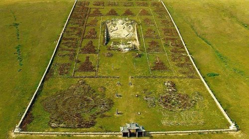
This stone monument is an important historical, cultural and astronomical sight in Mongolia. This stone deity was created in the years of 1859-1864 by the initiative of B.Togtokhtur, known as “To Van” throughout Mongolia. In the mid of nineteenth century, drought and disaster occurred in the far east of Mongolia, this caused livestock to die off and people to suffer. In order to stop the disaster, Togtokhtur Van had a meeting with the other monks to decide to erect the city of Janraisag. Experts believe that when To Van knew that the wealth of Mongolia was being sent abroad to worship Buddha so that he constructed this complex to keep the wealth that was generated by Mongolia’s ancestors in their motherland.
The role of 8 handed deity Janraisag is to protect the people from 8 kinds of suffering. This Janraisag deity located at the foot of the hill. In prospective hands of the deity, it holds items representing a lion, an elephant, a snake, fire, water, a chain, a cuff, and mind. This statue is 30m long and 1-3 m deep in the rock. The stones used to build the monument were pulled to the construction site by 1000 ox drawn carts. The construction required 180 craftsmen to complete it.
Around the statue, there are 12 stupas and 20 smaller statues of beautiful works of art. It is one of the largest and tallest statues of the Janraisag deity in Mongolia. In fact, only 3 statues depicting this deity exist. The second one is located in the city of Ulaanbaatar. This statue is 26 meter high and it was made by copper and covered with gold. However, the stones of the monument looks like got melt it was carved on the stone and it is unknown until today how it was made.
Between 1930 and 1940, during Stalin's purge, most of the statues were destroyed, although, Japanese soldiers who attacked the river Khalkh in the east side of Mongolia did not dare to get close to the deity Janraisag. In the 1997, during the renaissance of Buddhism in Mongolia, deity Janraisag was consecrated again.
KHARKHORIN
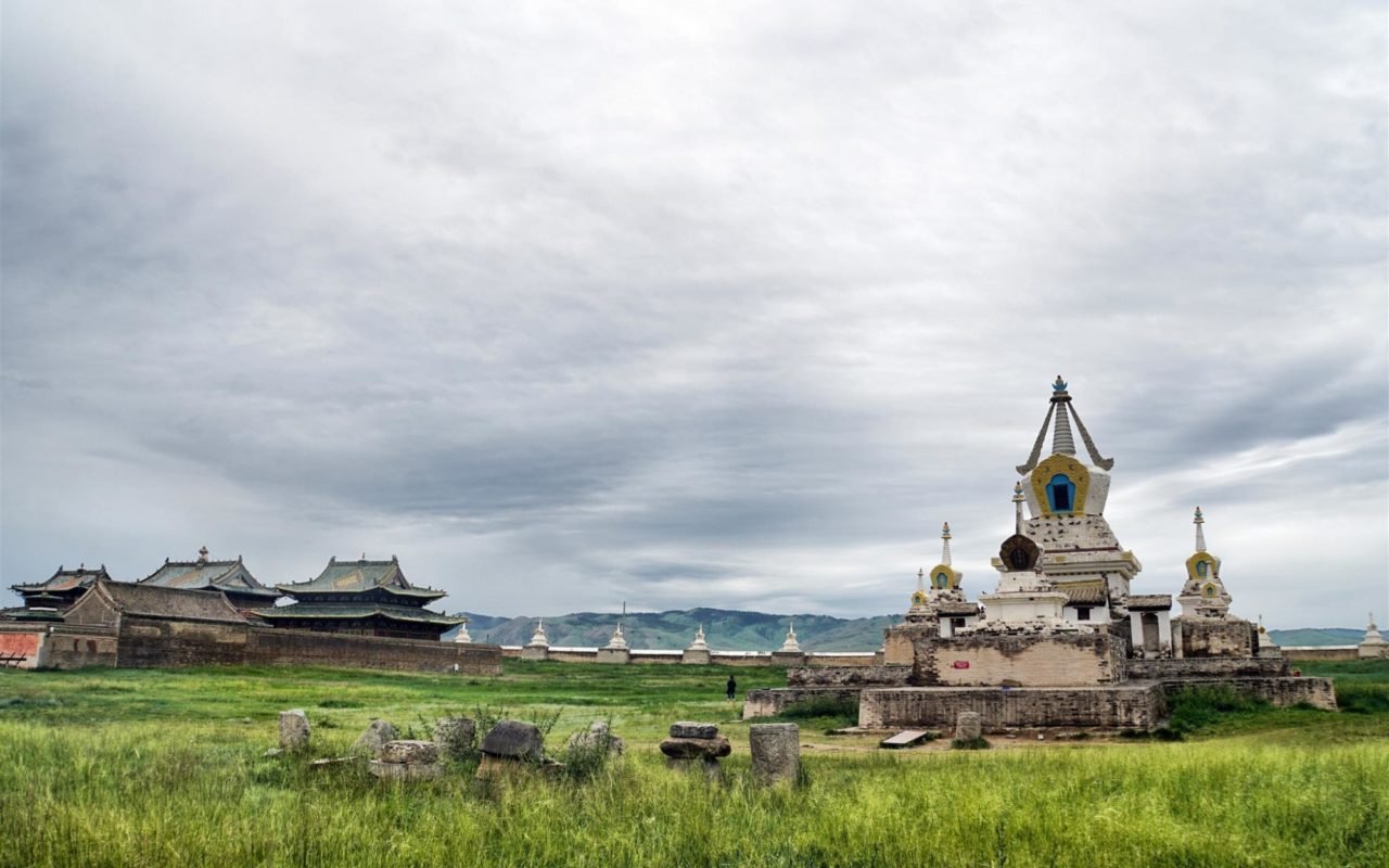
The people who study world history, know about Kharkhorin city. In 1206 Chinggis khaan established the Mongolian Great Empire and built the capital city of Kharkhorin. Researchers say Orkhon Valley is Mongolian geographic center and gene, and that Mongolian ancient tribes used to unite to focus to get the strength. "Kharkhorin" is the Uighur word meaning "dark brown dirt soil." Kharkhorin is surrounded by big walls, four palaces of Tumen amgalant had a green tile floor, a large tree sculpted of silver and other precious metals rose up from the middle of the courtyard and loomed over the palace, with the branches of the tree extended into the building. Silver fruit hung from the limbs and it had four golden serpents braided around the trunk, while within the top of the tree was placed a trumpet angel, all is performing for the emperor's pleasure.
The four corners of the gate had a trading market, shining monuments on the four turtle are in four corners, Christianity, Islamic, Buddhist religion, 12 Buddhist temples were settled and artisan districts and traders were to the streets of major cities. In 1380, 1466 the Ming state attacked the city, since then it failed to recover but so far the glory of the name is not forgotten. In 1996, Mongolian and Japanese scientists did a detailed topographic and concluded that there is 100 years of research left. Even though Kharkhorin was the capital city of Mongolia, it was not the center that the kings used to make political policy. The captured people are Roman Pontifical Plano Carpini in 1246, Wilgelm De Rubruk in 1253, Marco Polo who came to Kharkhorin near the Kubilai khaan in 1271, made the Kharkhorin city famous in the world.
Every year 30,000 tourists visit Kharkhorin city to imagine ancient capital city as exist now. Visiting Kharkhorin is an amazing experience to feel an old world capital. You will wonder what is left and what is still exist.
KHAR ZURKHNY KHUKH NUUR (KHAR ZURKH MOUNTAIN & KHUKH LAKE)
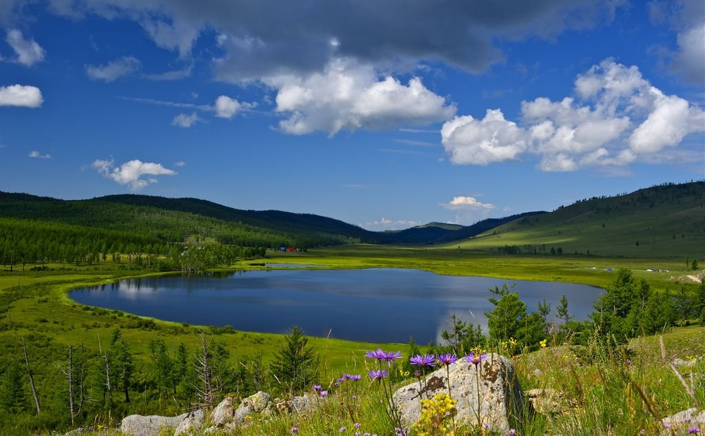
This lake is situated near Tsenkher River 35km north from the main road in eastern region and northwest from Tsenkhermandal Soum, Khentii Aimag. A fresh watered Lake Khukh which consists of 2 lakes, linked underground, is located on south of Mount Kharzurkh 1675m above sea level. Area around the lake is a place of natural beauty surrounded by a mountain and is abundant of various species of animal and vegetation. In this place Temuujin was enthroned as a king of united tribes of Mongolia and titled as “Genghis khan” which means Oceanic great king in 1189. In the Secret History of Mongols, a chronicle book of Genghis khan’s life, place names such as Lake Khukh, Mount Kharzurkh and Sengur Gorkhi were mentioned. On a bank of the lake there is a monument dedicated to 840 years’ birth anniversary of Genghis khan and in a crescent-shaped area with a diameter of 108m surrounding the monument, woodcrafts of 36 royal or golden lineage kings were placed. On the central part of this establishment woodcrafts of Genghis khan, his father Esukhei, mother Oulen and his queen Borte Ujin were posed. Boards with deeds’ inscription of a particular king along with specific events of that period in English and Mongolian are in front of the kings’ woodcrafts. This memorial complex consists of 50 woodcrafts including 9 marshals of Genghis khan placed at two sides of the main gate.
KHERLEN TOONO MOUNTAIN
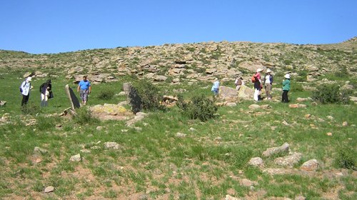
1578 m above sea level, this mountain rock is situated on east bank of Kherlen River south from Mount Kherlenbayan Ulaan. The mountain has a unique natural formation and contains several caves, Bronze Age burials, 2 big round Khirigsuur and graves belong to the Hunnu period. In the mountain there is a rock with an inscription about fighting between Galdan Boshigt of Oirad and Enkh-Amgalan khan of Manchu. This is known as Mount Toono Inscription. In 1955 Kh.Perlee studied this inscription which explained the victory of Enkh-Amgalan khan over Galdan Boshigt after 5-days battle in 1696. It is clear that this inscription was carved in 12th of May, 1696. In the inscription it said “Galdan vamoosed… Perhaps he has reached Bayanulaan. I think I will not be late if I chase with a large force… Galdan, being in stranded position, fled at night leaving all his weapons, shields, dwelling belongings, ill person and small children… I chased after him with a large force till Mount Toono.
KHERMEN TSAV
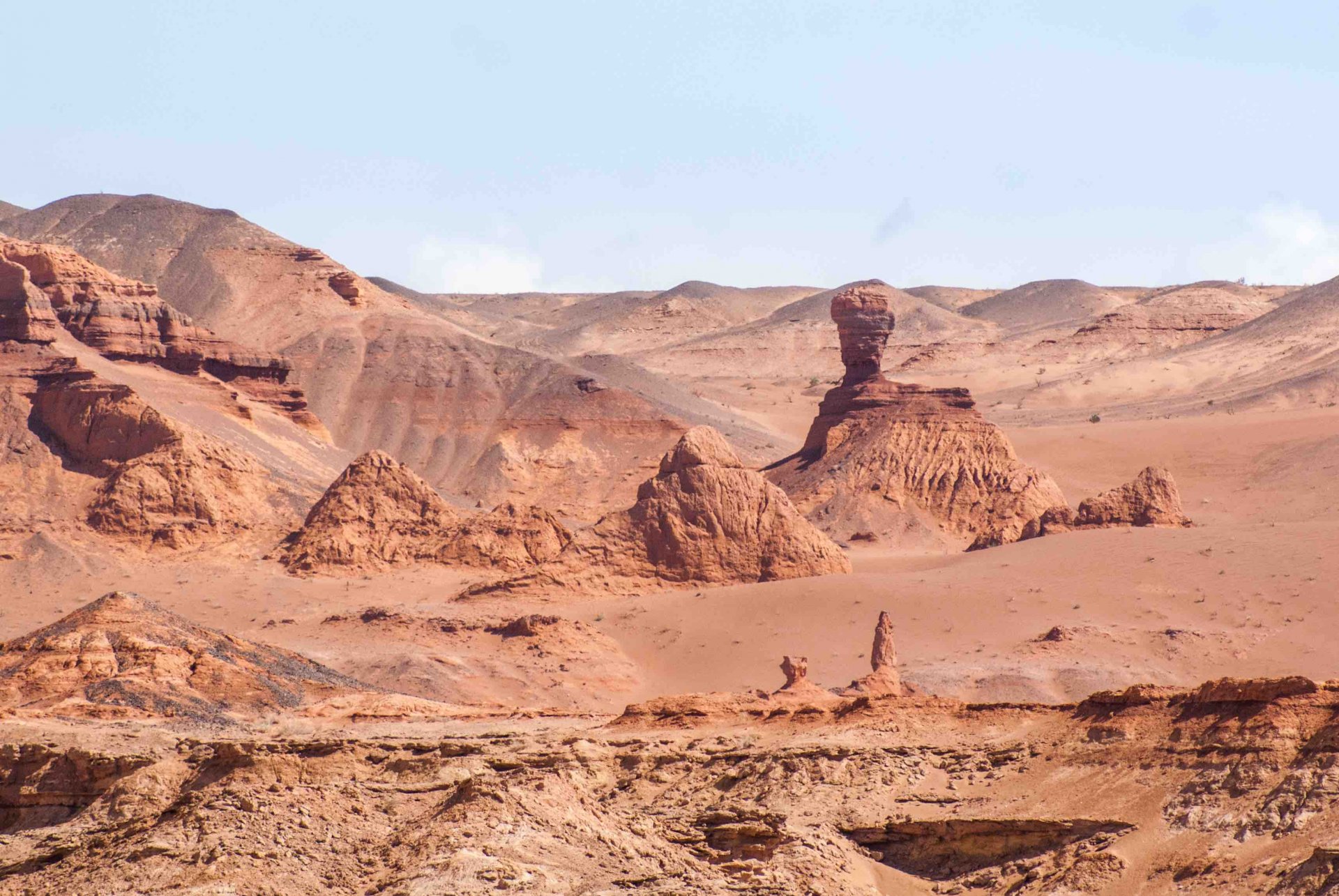
This escarp, stretched for about 10km, is situated northwest from Gurvantes Soum, Umnugobi Aimag. It is almost 10km broad at its end and reaches about 100-200m in depth at some parts. It looks like a big city ruin from far away. Covering area is 250 sq km and several dinosaur finds were found from the zone. It has not been completely excavated and supposed to have a great possibility of discovering more significant finds. Khermen Tsav is 250km away from Khongoryn Els and 450km from Dalanzadgad. On the way to the Khermen Tsav, there are some sights to visit such as Zulganai, Narandaats, Gurvantes.
KHOID TSENKHER CAVE
Caves are Common Natural creations which are one of the Basic Tourist Attraction on Mongolia. Caves as unique Natural Creations and rare exhibit have attracted researchers’ attention since early times. There is a survey indicating that there are 200 caves with more than 3 meter length. Another 80 might-be-caves have been recorded. These pits however are shut and if you listen to them you would hear minor sounds. The older the caves, the closer they are ground surface. On the contrary the younger caves are far away from ground surface. The most of the caves are poor in animals and plants. In most cases owners of the caves are bats. Some living beings tend to adapt to darkness in caves and stay to live there. For instance: crystal clear colored ants inhabit at Eregneg cave located in Tuv province.
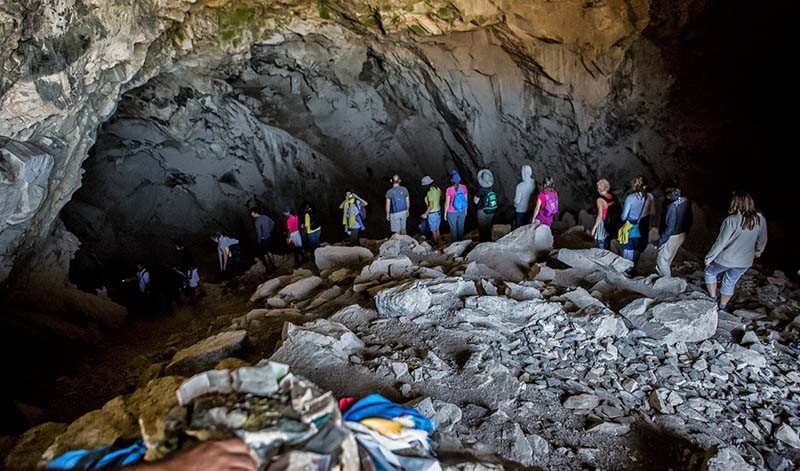
The Khoid Tsenkher cave is famous for its rock arts and is wonderful domestic and international tourist destination. It is situated 25 kilometers away from Mankhan soum of Khovd Province. If you walk 7 kilometers up the Tsenkher River you will directly reach the Cave. The elevation of the Khoid Tsenkher Cave is 1571 meters above. This cave was first discovered in 1951 by O.Namnandorj who had great interest on rock art inside the Cave. Since then the Cave has come to public attention. By that time Russian Scholar A.P. Okladnikow placed high value on this discovery and named it “Valuable contribution to the development of the world science” Dr.D. Maidar, a Mongolian researcher described the rock arts be the most astonishing among the Stone age findings. The Khoid Tsenkher Cave looks like it has two entrances as the half of actual entrance is sealed with rocks, stones felling off the top and bird faces. The height of the Cave is 20 meters. There are a number of long domes hanging down the ceiling.
(Rock arts of an Artist from 30-40 thousand years ago) The walls and ceiling of the Cave have ancient rock arts. The artists must have worked hard to leave their wonderful creations to us. The rock arts had been created by using sharp-edged stones and coated with ocher and dazzle paints. The artists had used two colors in his creations: heavy and light pinkish. These Brilliant rock arts are considered the most ancient in Central Asia. The Scientists have observed unique aesthetics tradition out of the rock arts. Wild ox with sword-like horns, wild goats and sheep, horses, camels, elephants, snakes, ostrich-like birds etc which signify that Mongolia had once been a warmer country. This art confirms that Mongolian people had lived in the same era with ostrich.
These rock arts have been fingerprinted in many parts which tell us that the art may belong to Paleolithic era, during which people had used their finger to form rock art. Depiction of ox on rock is somewhat popular during primitive society in France and Spain. Spruces grown around the Cave area are very commonly seen at European old stone art. This means that outlook of the artists of Stone Age was similar with those of Europe. In this view, a conclusion that these rocks clearly demonstrate signs of formation of art of human being was suffered from devastating ice coverage which resulted in extinction of these animals. The rock arts have been speculated to have formed 30,000-40,000 years ago. Most interestingly, these rock arts depicting animals of that age never portrayed human beings.
Some archeologists have discovered extraordinary settlement and province of Paleolithic and Mesolithic Eras after Thorough research of the Khoid Tsenkher Cave and Surroundings. In light of this, we may refer to the Khoid Tsenkher Cave cultural and historical memory as the Cave itself along with findings from neighboring area involves a vast territory. Scientists consider that creation of art is specific to not only western part of Mongolia but in Central Asia and Eastern part of Mongolia. In 1996 the UNESCO has enlisted this amazing Cave into the World Heritage Tentative List.
The first study by Kh.Perlee in 1943 triggered off annual expeditions in 1960-1980. A research work on seal imprints of Rashaan Khad was produced. A research on the Bronze Age initiated in 1973-1974 by “Gurvan Gol” expedition group, but beginning from 1980-1981 Mongol-Soviet joint expedition continued the work. During the last expedition it was proved that the settlement had 4 layers which are 2.5-3.5m in depth and about 2500 stone tools, bones of several types of animals were found. The most significant find among them was a tusk of rhinoceros. People of the Paleolithic Era who lived around the Khentii range and Rashaan Khad had been making various flint tools in order to hunt a khulan, a mammoth and a rhino. This ancient lifestyle was depicted on the rock.
15000-8000 years ahead of time Central Asian climate changed dramatically and huge animals began to die out. This forced primitive people to hunt quicker and smaller animals. So, they came up with bow and arrow best fit to hunt these animals. During this period people also began to move or migrate more often. Stone tools of particular period which were found in Mongolia, especially those called Goviin Uldets by scholars, were also found in Siberia, Far East, North China, Korea, Hokkaido of Japan as well as Alaska of USA.
KHONGOR SAND DUNES
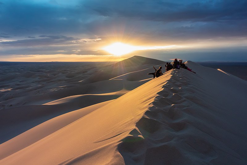
Khongor sand dune is one of the largest and most spectacular sand dunes in Mongolia standing as high as 200 meters above the ground, 7-8 km wide and 180 km long. The dunes rise up between Altai Mountains to the south, and stream and oases on the north side with lush green. Climbing the dunes is breathtaking, not only for the view at the top. It surprises climbers that the sand dunes make a singing sound while you climb.
Khongor sand dunes are also knows as singing sands. Once you are up on the top of sand dunes, the sound of people or animal is heard clear, the people and the cars in the slope of the dunes will look like a tiny bug. Many tourists are visiting to the Mongolian Gobi. The sand dunes make you feel extraordinary comfort and infinite peace. A number of tourists are visiting to the South Gobi to see a sunset and a sunrise from the top of the sand dunes. You will have a great experience visiting to the Mongolian Gobi desert.
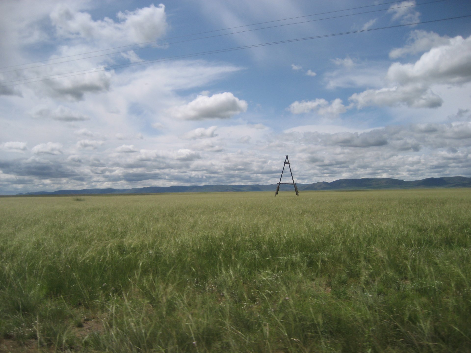
KHUDUU ARAL
This 30km long, 20km wide steppe is situated south from Mountain Kherlenbayan Ulaan and west from Mountain Kherlen Toono in Khentii province. This is a historically important place where Ikh Khuraldai used to take place and Ugudei, Munkh, Yesuntumur khaans were enthroned as a king. There are several lakes including Lake Khuduu, Lake Toson, Lake Zamag and Lake Tsagaan. 7 small hills-Durvuljin, Suul, Ikh Ulaan Tolgoy, Baga Ulaan Tolgoy, Olon Ovoo and Takhilgat Gatsaa- are situated on a sunny side of Mountain Kherlenbayan. Scientists believe that the place called Doloon Boldog in book of The Secret History of Mongols refers to these 7 small hills.
In 1990, a 4m high Chinghis khaan’s monument was built for 750th anniversary of the book of “Secret History of Mongols”. Standing Chinghis khaan was depicted on a face of the monument and the end note of “Secret History of Mongols” was inscribed on the west side. On the east and north side, cavalrymen along with tribe seal imprints of that time were carved. There are some historical sight such as the Aurag city ruin in Rashaan Dersny Ukhaa and the Aurag spring to the south from the monument. “Khuduu Aral” tourist camp is located 11km north from the monument. Mountain Toono where Galdan Boshigt fought against the Manchurians, can be seen from southeast of Khuduu Aral. Mountain Kherlenbayan Ulaan is situated on northwest of it. Thus, Khuduu Aral was the safest place protected on all 4 sides surrounded by Mountain Kherlenbayan Ulaan, Mountain Toono, River Kherlen and River Sengur.
KHUIS TSEG (HEART OF MONGOLIA)
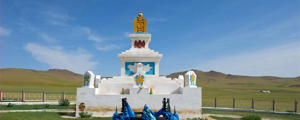
This place called Uvurkhushuutyn Bulgyn Ekh is the central point of Mongolia and it is situated at the coordinate of northern latitude of 460521 and eastern longitude of 1030501 which is 13,5km south from Burd Soum, Uvurkhangai province. In 1979, a geographer, Professor Sharavyn Shagdar determined this point and he had a stone cairn built to mark the location in 1989. Since then the locals has expanded it by erecting a stupa and a fence. The central point is located at the junction of the center of 2 circles: one passes through the most southern and northern point of Mongolia and another one which passes through the most eastern and western point of the country. By using a same method, all provinces and 318 Soums of Mongolia had their central points pinpointed and few of them had a monument built marking the location. Sh.Shagdar determined the central point of Mongolia by using a geographic coordinate system, a rectangle method, a quadratic equation as well as a circle method.
KHUSTAI NATIONAL PARK
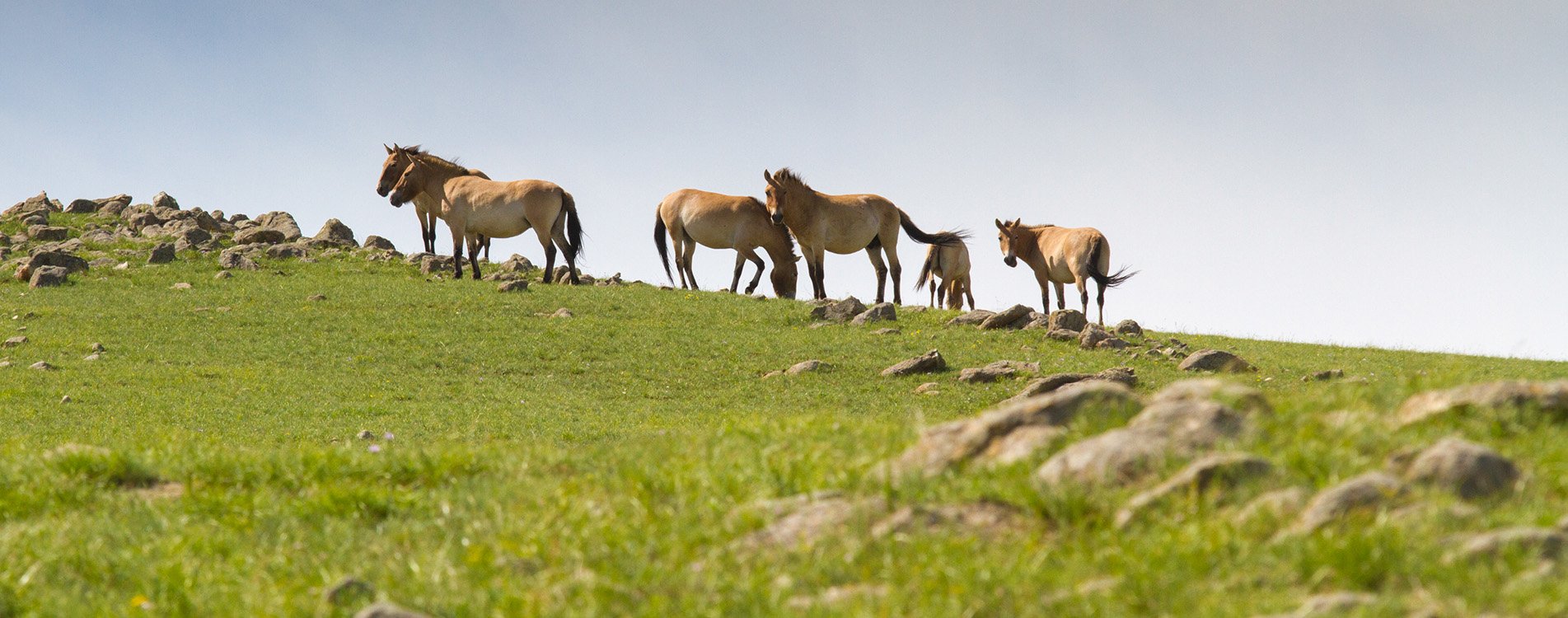
The national park is about 100 km south-west of Ulaanbaatar. Highest point is 1842 meters. There are over 10 pure water rivers, populations of Asian red deer, steppe gazelle, deer, boar, wild cat, wolf and lynx, 126 kinds or birds, 450 floras. In between 1992-2001 wild horse known as Takhi was reintroduced from Holland into Khustai National Park. A total of 84 Przewalski wild horses were brought 4 times. In the beginning of 1900s, wealthy zoo director from Hamburg in Germany came to Mongolia and bought 51 foals of wild horse and sold them to a wealthy people in Dutch, French, and America. Thus, Mongolian wild horses have been living in European countries since 1903. This wild horses exporting business was successful in Europe but Przewalski wild horses in Mongolia, motherland of wild horse, was extincted by 1960.
Now in Mongolia, there are nearly 350 numbers of wild horses. In order to protect the wild horses, Khustai Mountain became strictly protected area. Thus, many tourists like visiting the national park to see Przewalski's horses and another wild animal such as deer, marmot in the park.
KHUVSGUL LAKE
Lake Khuvsgul is known as Asian Switzerland and the Asian blue pearl. It is 1645 meters above sea level, 136 km long and 262 meters deep. It is the second-most voluminous freshwater lake in Asia and contains almost 70% of Mongolia's fresh water and 0.4% of all the fresh water in the world. The lake formed about 7 million years ago. Geologists say the lake is connected the Baikal Lake underground. Over 46 streams pour into Khuvsgul Lake that contains 12 species of fish, 4 large islands, and 70 percent of the lake is more than 100 meters deep, clear water reaches 24 meters. By the end of the November, water freezes completely 1 m thick ice. The lake is surrounded by high mountains which is 3000-3200 meters above sea level. Khuvsgul Lake has a legend about why Mongolians call the lake as an ocean Khuvsgul.
When Mongolia was under the Manchu depression, they were imposing tax from the natural resources to worsen Mongolian economy. Local people were angry about it and arguing Khuvsgul is not a lake, it is an ocean. The Manchu asked Mongolians how you prove the Lake is an ocean. They answered Khuvsgul is poured by the 100 rivers so it must be an ocean. Manchu officers knew about it, so they decided to count the rivers. The local residents live by the lake did a religious ceremony asking from the god to rain and flood the lake. According to locals wish, it was poured and surrounding area was flooded. Then Manchurians stopped to get tax and it was named as Khuvsgul Ocean.
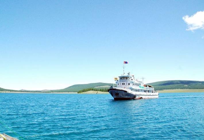
Tourists come to the lake not only seeing but also relaxing and traveling by modern motor boats to the island in the middle of the lake. You can travel by the “Sukhbaatar” ship running since 1910, for continually 30 years. Khuvsgul is famous not only in Mongolia also it is very famous in the world. You can visit to the reindeer people who still keep the ancient shaman rituals in Shishged khotgor.
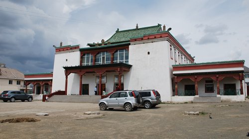
MANBA DATSAN MONASTERY
Training Center of Mongolian Traditional Medicine, Manba Datsan, was established to provide the people with high quality and sufficient medical services and to develop the achievements of contemporary medicine, training treatment medicament's production research and study of traditional medicine within the frame of the state policy.
The training center of Mongolian traditional medicine, Manba Datsan, has many branches like the Medical Institute Otoch Manramba, the Hospital Manba Datsan, the Medicament factory Manba Datsan, Medical Temple, Assisting the Others, the Dogdolgunselling Monastery in Zamyn Uud, Dornogobi province, the International Complex of Training, Treatment and Tourism, Mass Media Unit, Association “The Children of Manla Buddha” and the Unit for the public.
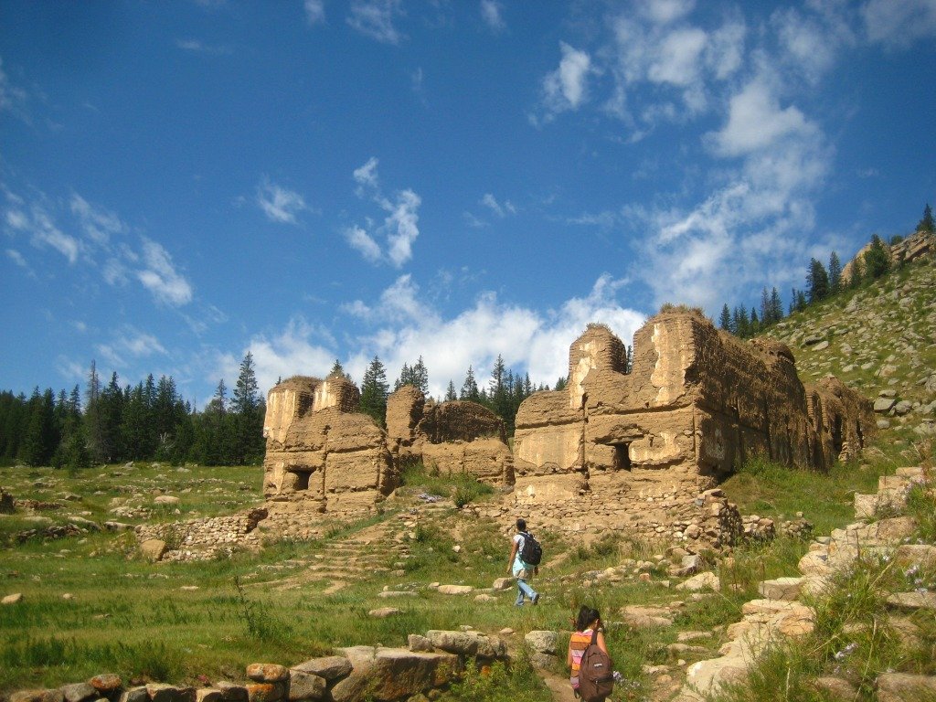
MANZUSHIR MONASTERY
The ruin of the monastery is located in Sergelen Soum in Tuv province and 8 km in the north of Zuunmod town. The construction of the monastery began in 1733 in the foot of Bogd Khan Mountain. In the end of the 18th century, it extended a main temple. In the 20th century, there were around 500 monks. The monastery which has its own rich history was destroyed in 1937 during the socialist era. During that time, there were approximately 21 temples. In 1998, the building and ruins were taken under state protection. Today “Lavrin” temple which was restored after 1998 is used as a natural museum and there is a huge pot made in 1726 for 1000 people.
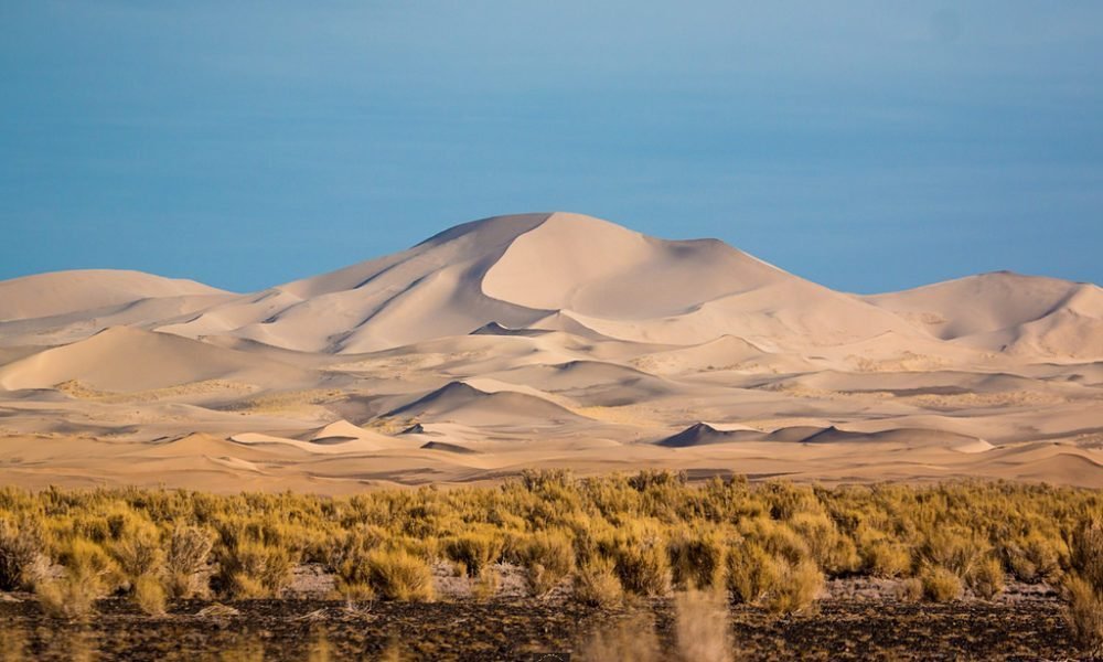
MOLTSOG ELS (MOLTSOG SAND DUNES)
This long sand dune is situated in the northeast of Flaming Cliffs which is 55km from “Juulchin Gobi” tourist camp in Bulgan Soum, Umnugobi province. If there is no “Khongoryn Els” in your itinerary, then you can visit Moltsog Els and go on a camelback trekking. After that you can also make a quick visit to the Flaming Cliffs and Shiree Shavar.
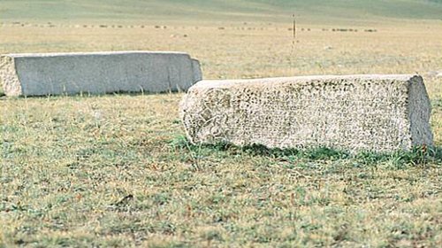
MOYUNCHUR STELE
It is situated in Khirgist valley in Saikhan Soum, Bulgan province. This memorial has a significant importance of Uighar state history as well as its culture. Inscription on it was written in runic script. Height of the stele is 3.8 meters. At first, it was placed on the turtle stone base, but later separated from the base by falling down and broken into two parts. Inscription consists of 44 rows and each row has about 150 letters written on the stele. Nearly 1750 letters of total 6750 letters disappeared due to external influence. Uighar’s second king Moyunchur, a son of first king Peilo, had this stele built. He was a king in 745-759 and had Uighar history of 744-750s written on the stele.
NOGOON NUUR (GREEN LAKE)
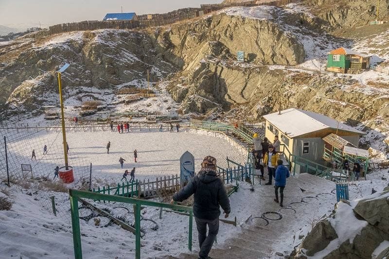
Dash Sandag, 89-year-old, is a meritorious worker of the Road Construction of Mongolia. When I was demobilized from the army in 1950, I was employed in the stone crushing and gravel preparing factory located at the place Uuliin Nuur (former name is Chuluun Toochig) and worked in charge for equipment and tools of the prisoners who prepared the stones by crushing them in this place and received those stones by measuring. Those prisoners were placed in semi-whole shelters named Zemlyak and they worked from 7 am to 9 pm. 12 pm – 13 pm, they made blasting and released the rocks and stones.
In this place, 1000 cubic meters of crushed stones were prepared by the force of the Japanese soldiers who were captured during the war of 1946 and those crushed stones were used for constructing the road on the west of the National University of Mongolia and 11,000 cubic meters of crushed stones required to construct the Sukhbaatar square were prepared in this place in 1946-1947. Moreover, when constructing the 15 km of long road from Central Post Office until the Airport, the gravels were taken from here. In the beginning, they made blasting, sometimes shot by the artillery to prepare and they collected the released stones using the forces and labors of many people.
They recognized the quality of the stones of this place and started using them so that there were good traffic road engineers and professionals were among the Japanese soldiers.
ONGI MONASTERY
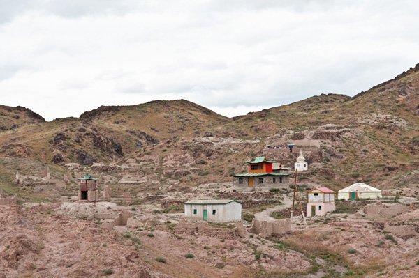
It is located in Saihan-Ovoo Soum of Dundgovi province. One of the biggest monasteries in Mongolia, Ongi, was founded in 1660 and consisted of two temple complexes on the North and South banks of the river Ongi. At its heyday, Ongi monastery consisted of over 30 temples, 4 big Buddhism universities and over 1000 monks at a time. During 1930s, communism spread throughout Mongolia. Both complexes of Ongi Monastery were completely destroyed in 1939 during anti-religious purges, over 200 monks were killed, and many surviving monks were imprisoned or forced to conscript into the Communist controlled army. Other monks escaped becoming farmers and common workers. In 1990, after the democratization in Mongolia, some monks returned to the monastery and began their Buddhist education as young children some 60 year prior. At present, one temple has been fully rebuilt, small museums and ruins of the temples.
ORDUBALIK (KHAR BALGAS
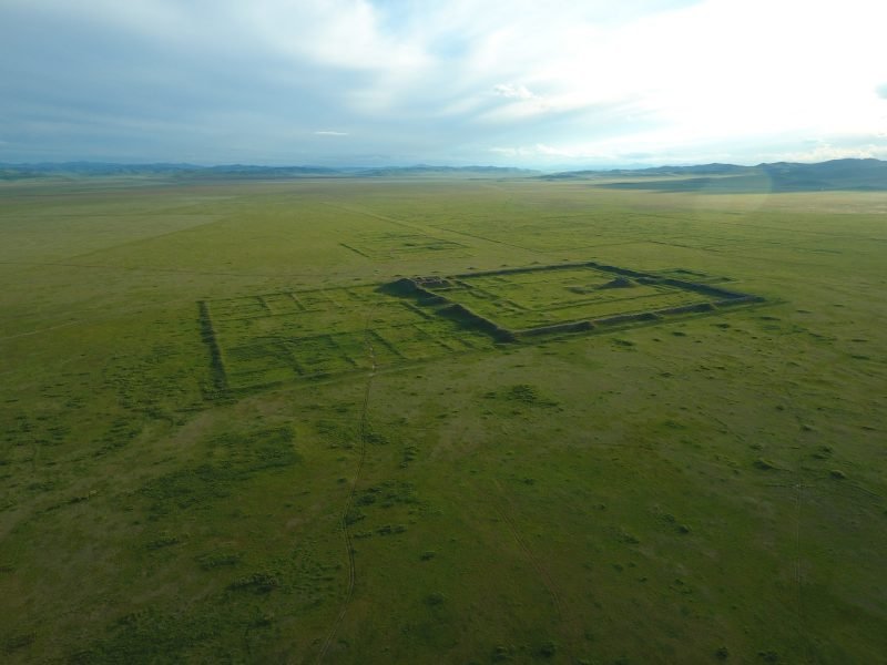
This Uighar capital ruin founded in 751 is situated on east bank of the Orkhon River, 15km northeast from Khotont Soum in Arkhangai province. After Uighar’s victory over Turkic empire in 745, Peilo became a new king of Uighar Empire. After his death, his son Moyunchur became Uighar king. During his reign, Uighar experienced the most flourishing time of its history and established the capital, Ordubalik, in Orkhon river valley.
Although over 10 cities were established during Uighar period, only two ruins of them (Ordubalik and Baibalik) were remained today. This city was a fortified castle and one of the main trade centers in Central Asia where Silk Road passed through. Ordubalik and Karakorum controlled northern branch of the Silk Road for over 400 years. Study on this city ruins proved that there were a state house, a state ministry, a cottage industry, trade districts, a religious temple, a fortified castle, a horse shed and a military warehouse in the city which stretches southwardly over 25km.
Decorated royal house remains were found inside the fortress during the excavation. In front of the fortress, there were a garden, a worship temple surrounded by a fortress and steles devoted to Uighar king with an inscription in Uighar and Chinese script in front of the temple. Many building traces on western and northwestern section of the city are supposed to be establishments which have formerly been used for a trade and a handicraft. Ordubalik was a big city. But it was not existed more than 100 years. In 840s, Kyrgizs from Yenisei River burned down the city. Khar Balgas was not only registered as an important historical site under state protection in 2002 but also recognized as a cultural landscape of the UNESCO World Heritage in 1996.
ORKHON WATERFALL
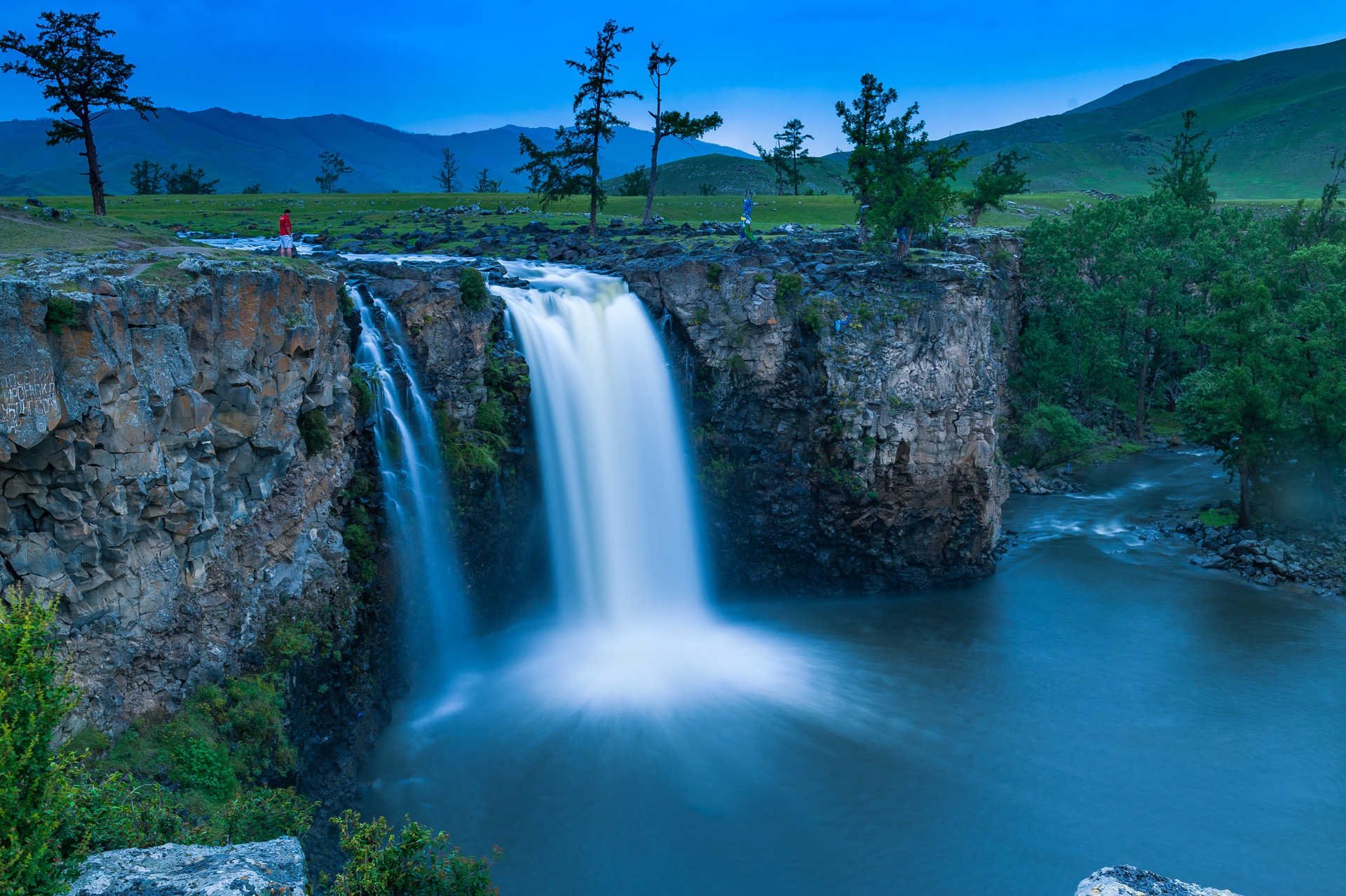
Orkhon waterfall, also known as Ulaan Tsutgalan, is one of the most impressive sights in central Mongolia. The waterfall is located 100km from Kharkhorin Soum can be reached in 4-5 hours from the city and in 2-3 hours from Tuvkhun secret monastery. The water fall is ten meters wide and twenty meters high.
In 2.5 million years ago, earthquakes and volcanic eruptions occurred at the head of the Tsagaan Azarga River, located in the Khangai mountain range. The hot lava created a layer of thick basalt stone mulch that is hundreds of km deep. Geologist think that The Orkhon River flow on the basalt stone river created a massive canyon.
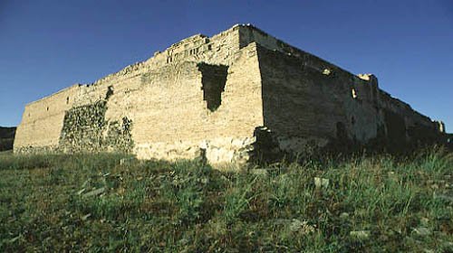
PRINCE TSOGT’S WHITE HOUSE
This castle ruin is situated near Mount Khaldunzurkh in a valley of Tuul River 20km northeast from Chin Tolgoyn Kherem in Dashinchilen Soum, Bulgan province. It was formerly a castle of Queen Madai Taigal, a mother of Prince Tsogt. This temple designed castle with a tiled roof was surrounded by several small fortresses. The fortress had a gate in the south. There are many remains, perhaps, any settlement surrounding the castle. Therefore, it is said that many people inhabited around the castle. This castle was designed alike buildings in ancient capital Karakorum and there was a big library which is rich with Buddhist sutras and various kinds of books. In eastern hill of the castle, there was a turtle stone much same as that of Karakorum.
This hill is called Melkhiit. Currently, there are wall remains of building, a stone pedestal and a Stele. The inscription in Mongolian and Tibetan was about a construction work of the castle memorial started in 1601. And also it said that ”On western bank of Tuul River south of Mount Khaldunzurkh, 6 temples had been built over 17 years of time”. Buildings in this memorial were not restored well due to frequent fighting among domestic noblemen in 1627-1630. However, it was taken under state protection in 1971. This area in Tuul River valley is called Bor Bulan and it is never droughty in summer. Mount Zaamar, 20km northeast from the site, is a zone without harsh winter called zud. (A zud is a Mongolian term for an extremely snowy winter on which livestock are unable to find fodder through the snow cover, and large numbers of animals die due to starvation and the cold.) So, area around the castle is named as “Never droughty Bor Bulan, Toson Zaamar without zud”.
Prince Tsogt: He was born in 1581 becoming a son of Major Baarai, a direct descendent of Chinghis khaan’s golden lineage. Prince Tsogt was one of few educated people of the period who was literate via home schooling. He was a military man, a translator and a poet who follows a red sect of Buddhism and was also a persistent supporter of Ligden khan’s policy. He was recorded in history because he had been fighting for the independence of his country by leading 40,000 soldiers. He willy-nilly moved to Lake Khukh leaving home country being persecuted by noblemen who followed Manchu and joined with Ligden khan to fight against Manchu. He was died in a battle field in 1637.
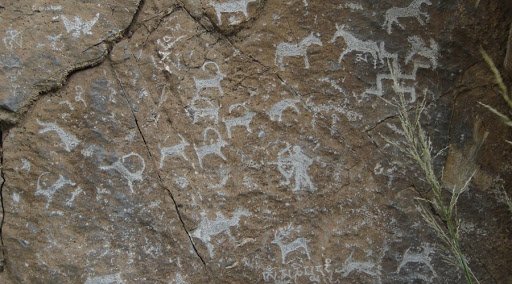
RASHAAN KHAD (RASHAAN ROCK)
Rashaan Khad is situated near southeast end of Mount Binder in Batshireet Soum of Khentii province. Archeologists signify this complex which belongs to the period between Stone Age and the 16th century, as an important representative of memorials in eastern Mongolia. Surrounding area is full of cave paintings, various kinds of inscriptions, stone tools and graves of the Bronze Age, the Iron Age as well as the Hun period. Besides them, there are also historical memorials belong to the Bronze Age, the Khitan period and the Mongol Empire. On this cave there are stencil paintings of games and a human figure, hundreds of seal imprints of tribes and over 20 inscriptions in Khitan, Arabian, Persian, Tibetan, Chinese as well as Mongolian script.
Rock paintings on Rashaan Khad: Hundreds of animal figures, seal imprints and inscriptions in various scripts all of which belong to the Paleolithic period or the Mesolithic period are found on Rashaan Khad. During his expeditions in 1943 and 1968, Kh.Perlee discovered 180 images on the foreside, over 40 on the backside and about 50 on the crest of a granite stone facing east. On the rock west of Rashaan Khad, a high finned, a short fat legged and a long trunked mammoth was depicted. This figure was much same as that of the Kapovoi cave in Ural mountain range and caves in Europe. On another flat rock flock of three rhinos were depicted in huge with a high fin, short legs and a special attention was put on a tusk and horns over its nose.
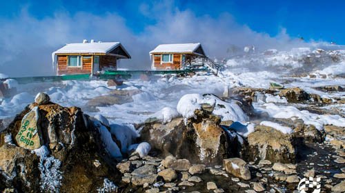
SHARGALJUUT THERMAL SPRING RESORT
History: Mongolian people have been using the Shargaljuut mineral water for thousands of year to cure their diseases. By the end of the 17th century, Dorjrinchin together with Mongolian and Tibetan therapist determined how to use over 50 kinds of mineral waters for curing diseases and announced it to the public. Not only Mongolians also foreigners including Chinese and Russians used to visit the Shargaljuut mineral water for treatments during the autonomous governance. During the 18 and 19th centuries, famous monk Khalkha Zaya Bandita Luvsanperenlei authored the Shargaljuut mineral water treatment sutra. Moreover, in 1850, Undur Gegeen Zanabazar (1635-1723), the first Jebtsun dampa Khutukhtu and one of the great figures of Mongolian Buddhism wrote two books about rules to use the Shargaljuut mineral waters. Top ranking royalties and Buddhist monks Undur Gegeen Zanabazar, Lamyn Gegeen and Khutugtu Tserendorj as well as Sain Noyon Khan, Governor of Sain Noyon Khan Province, used to visit the Shargaljuut mineral water. So, it was named as the mineral water for nobilities.
Location: Shargaljuut spa resort located in the beautiful scenery place along the bank of Shargaljuut River in Erdenetsogt Soum of Baynkhongor province.
Height: Located in the mountain slope, elevated 2150m above sea level.
Establishment: Originally in 1954 by based on the Shargaljuut group of mineral water.
River: The Shargaljuut riffle flows throughout the 4 season of the year.
Climate: Four seasons in a year and by the effect of hot spring evaporation, climate is comparatively warm and humid.
Capacity: In summer, The Shargaljuut spa resort has capacity to serve 500 persons in a shift, in cold season, 300 persons in a shift. A Company owned 20 hectares of land, 10 hectare mineral deposit. 6-7 million liters of mineral water naturally flows a day.


.jpg)


.jpg)